Aerial Photograph of Kent Lake, July 1949
Published In
Ann Arbor News, July 16, 1949
Caption
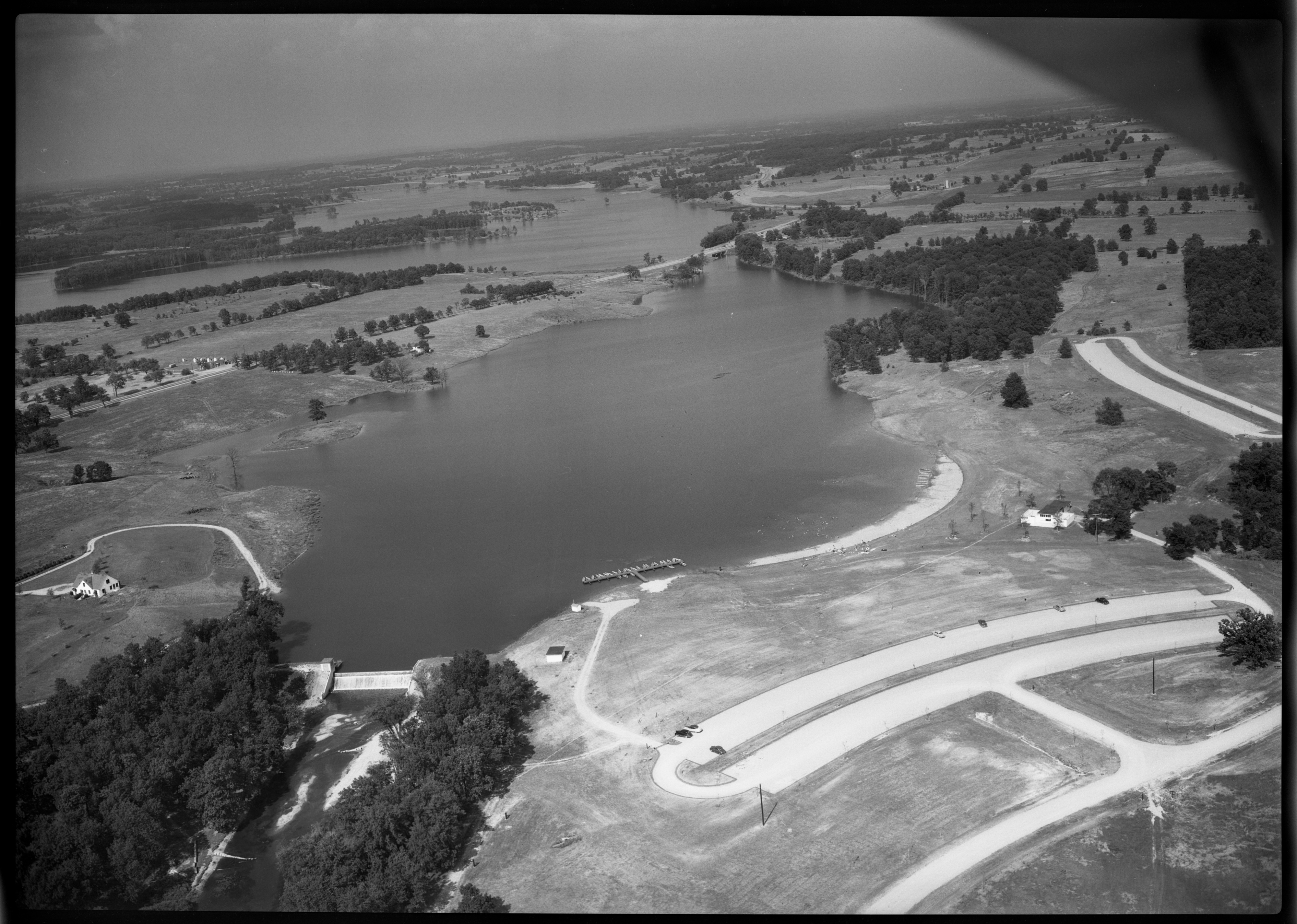
KENT LAKE: The above aerial view of Kent Lake shows the beautiful scenery and developments that have been accomplished there. Located on both sides of US-16 about three miles west of New Hudson, the lake is under the joint jurisdiction of the Huron-Clinton Valley Authority Association, north of the highway, and the Michigan Conservation Commission, to the south. Improvements and facilities there include recreational areas, swimming, picnicking, boating, camping and fishing. The beach is located at the right foreground and the specks just out into the lake are swimmers. The boat livery is to the left of the beach. In the bottom right are the large parking strips. At the bottom left is a flood control dam built across the entrance of the Huron River. Still in the process of development, the area is potentially one of the finest vacation playgrounds in the vicinity and attracts many residents from the Detroit area.
Ann Arbor News, July 16, 1949
Caption
KENT LAKE: The above aerial view of Kent Lake shows the beautiful scenery and developments that have been accomplished there. Located on both sides of US-16 about three miles west of New Hudson, the lake is under the joint jurisdiction of the Huron-Clinton Valley Authority Association, north of the highway, and the Michigan Conservation Commission, to the south. Improvements and facilities there include recreational areas, swimming, picnicking, boating, camping and fishing. The beach is located at the right foreground and the specks just out into the lake are swimmers. The boat livery is to the left of the beach. In the bottom right are the large parking strips. At the bottom left is a flood control dam built across the entrance of the Huron River. Still in the process of development, the area is potentially one of the finest vacation playgrounds in the vicinity and attracts many residents from the Detroit area.
Year
1949
Month
July
Rights Held By
Donated by the Ann Arbor News. © The Ann Arbor News.
Copyright
Copyright Protected
Photo
Subjects
Kent Lake
Aerial Photo
Old News
Ann Arbor News
Milford Charter Township