Map of Proposed Packard-Beakes Bypass, February 1972
Published In
Ann Arbor News, February 1, 1972
Caption
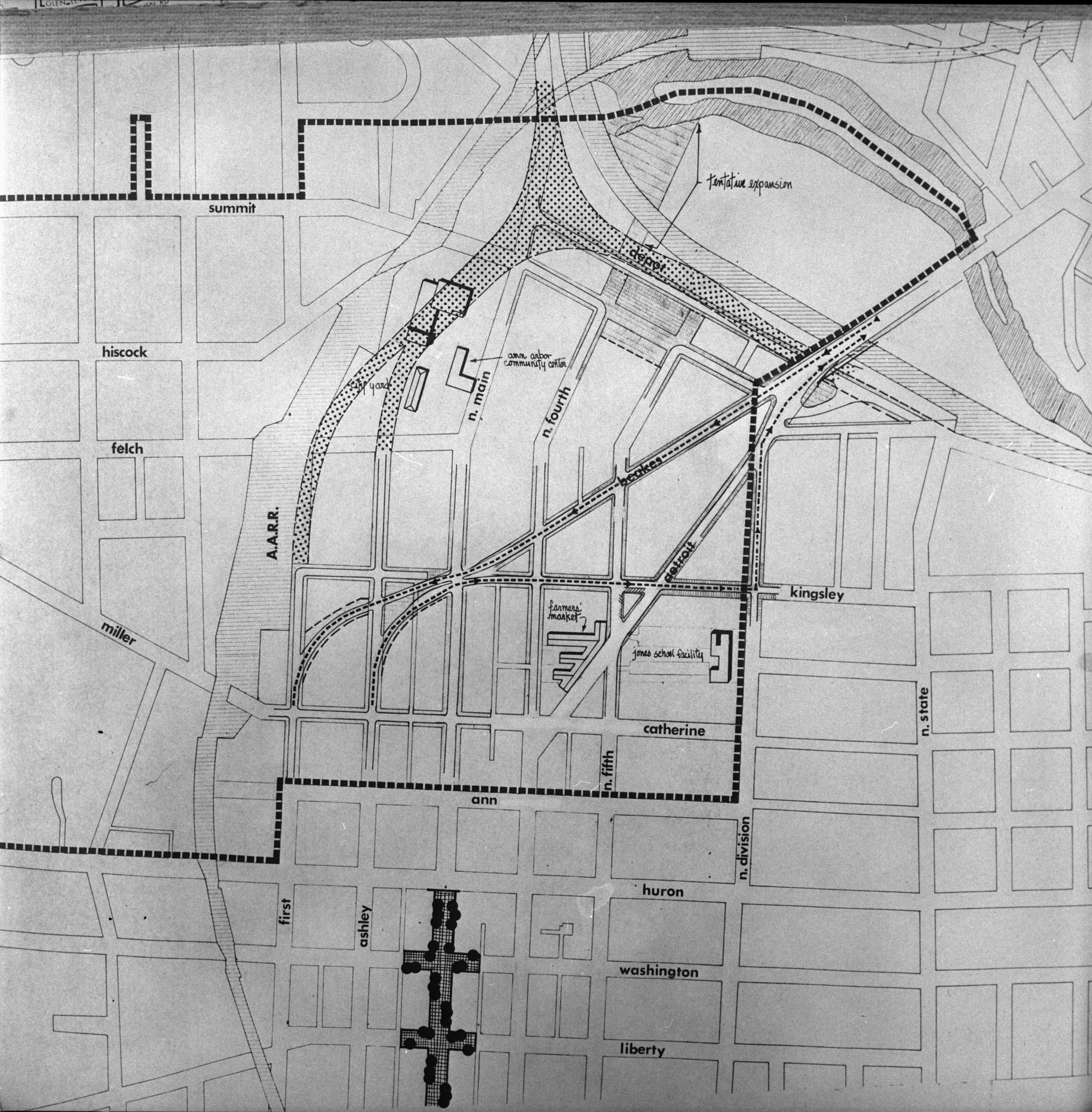
Packard-Beakes Route: This map focuses on the center of the controversial Packard-Beakes bypass, which was approved by City Council last night. It shows the northerly connection with Beakes and Kingsley as one-way pairs, Beakes handling inbound traffic and Kingsley the outbound motorists. Beakes and Kingsley would connect with Ashley and First (at left) which would then connect with Packard south of the Man St. business district. Arrows on the map indicate the traffic pattern which will result when--and if--the bypass is completed. The dotted-in diagram in the upper half of the map is the proposed alternative bypass route proposed by the Model Cities Policy Board, a routing termed too expensive by city officials. The route which was approved was first proposed six years ago. (Story on Page 1)
Ann Arbor News, February 1, 1972
Caption
Packard-Beakes Route: This map focuses on the center of the controversial Packard-Beakes bypass, which was approved by City Council last night. It shows the northerly connection with Beakes and Kingsley as one-way pairs, Beakes handling inbound traffic and Kingsley the outbound motorists. Beakes and Kingsley would connect with Ashley and First (at left) which would then connect with Packard south of the Man St. business district. Arrows on the map indicate the traffic pattern which will result when--and if--the bypass is completed. The dotted-in diagram in the upper half of the map is the proposed alternative bypass route proposed by the Model Cities Policy Board, a routing termed too expensive by city officials. The route which was approved was first proposed six years ago. (Story on Page 1)
Year
1972
Month
February
Day
1
Rights Held By
Donated by the Ann Arbor News. © The Ann Arbor News.
Copyright
Copyright Protected