Home In Saline Dates Back To President Tyler's Era
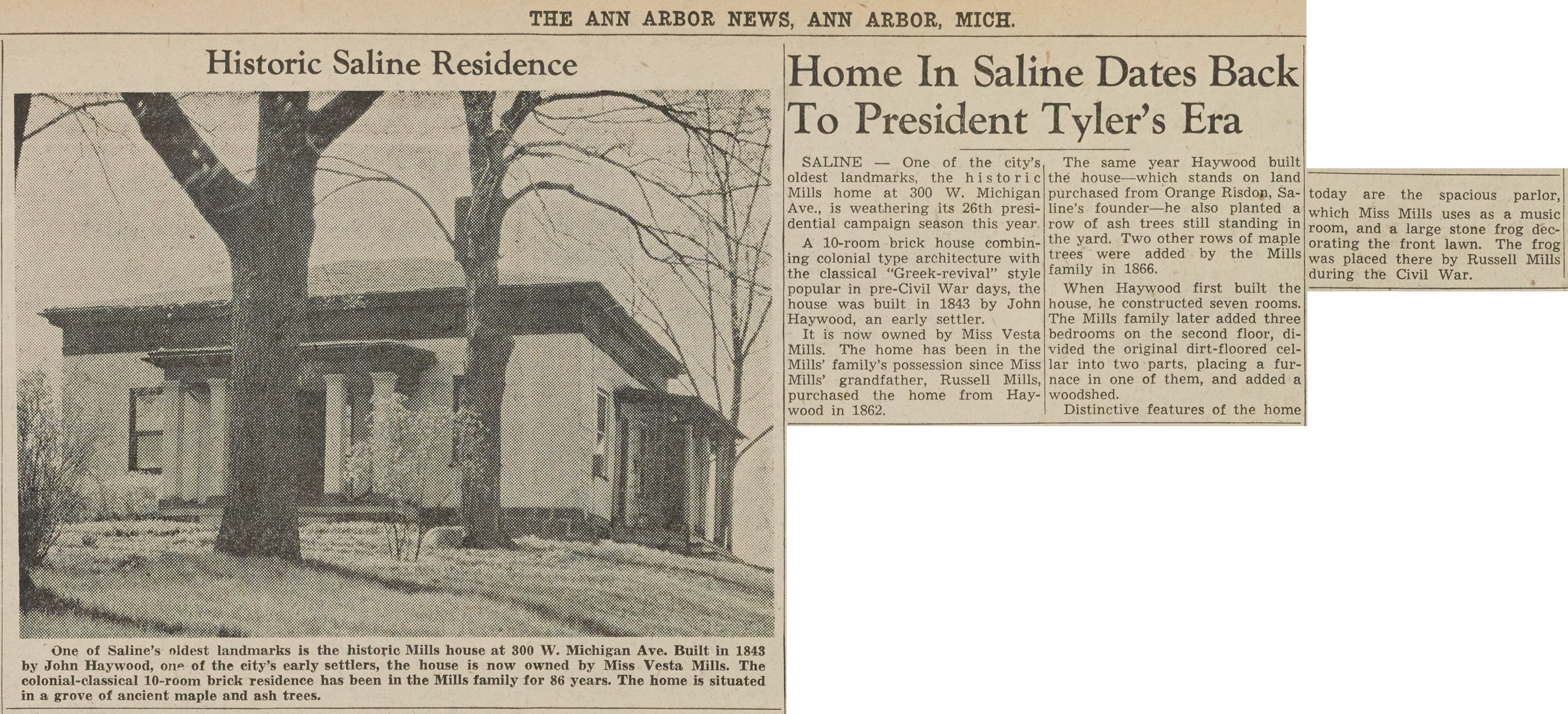
- Read more about Home In Saline Dates Back To President Tyler's Era
- Log in or register to post comments
Died

- Read more about Died
- Log in or register to post comments
Cindy Langer & Wayne Clements Survey Oakwood Cemetery In Saline, April 1990 Photographer: Colleen Fitzgerald
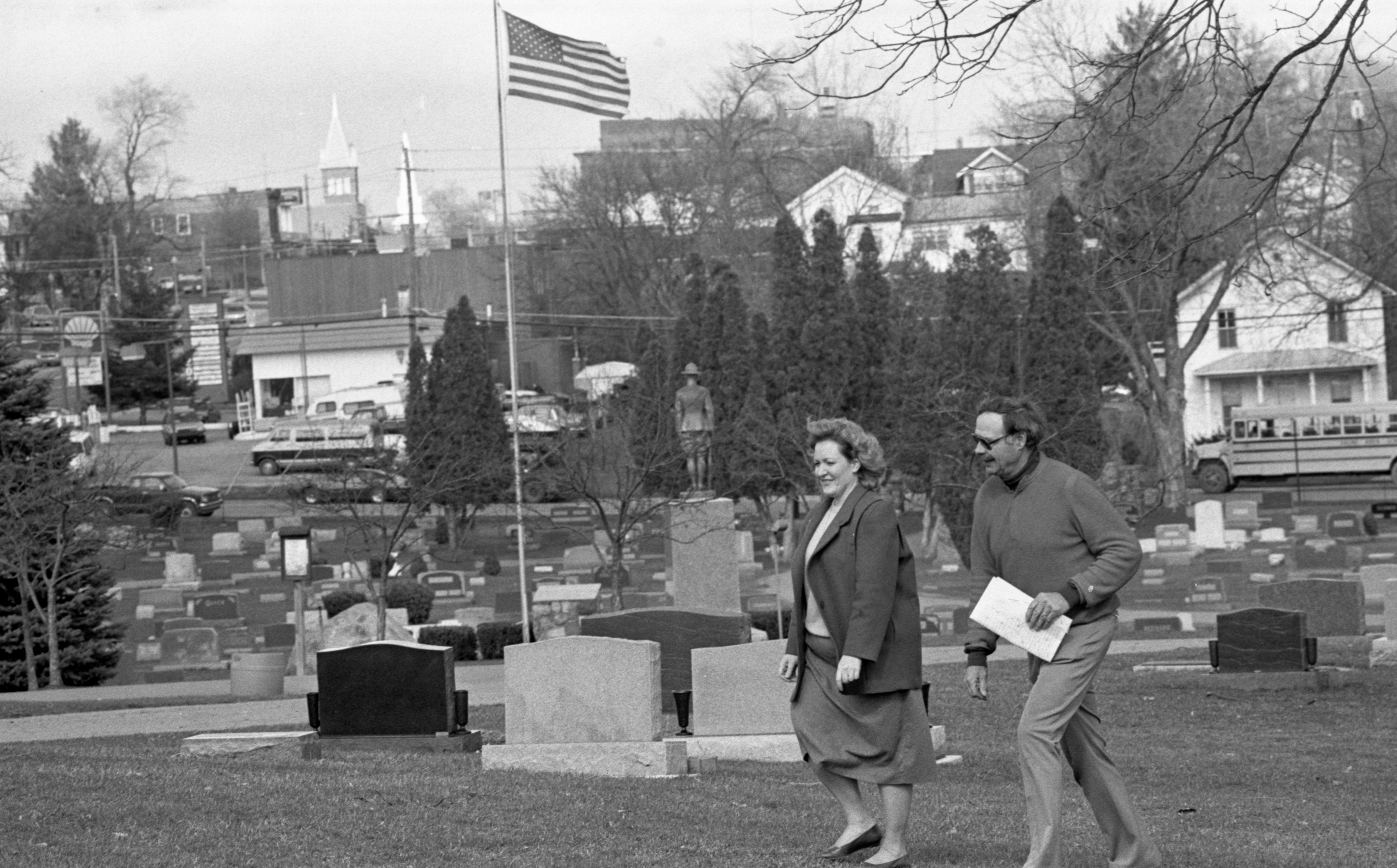
Year:
1990
Ann Arbor News, April 12, 1990
Caption:
Cindy Langer and Wayne Clements survey site where they want historic marker placed.
Grave question: What constitutes a cemetery?

- Read more about Grave question: What constitutes a cemetery?
- Log in or register to post comments
Ann Arbor Yesterdays ~ Early Maps

- Read more about Ann Arbor Yesterdays ~ Early Maps
- Log in or register to post comments
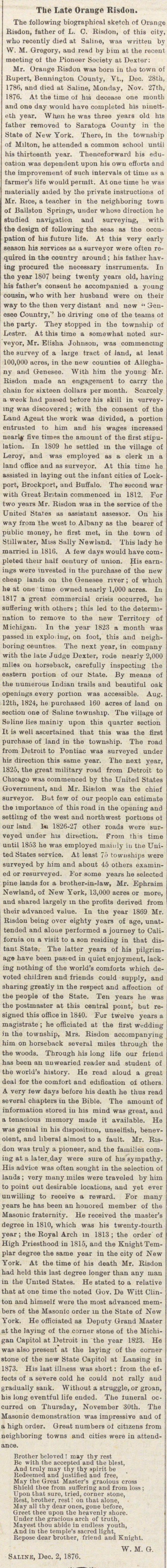
The Late Orange Risdon
- Read more about The Late Orange Risdon
- Log in or register to post comments
The Choice Of Orange Risdon
A surveyor found his own town site on the Chicago Road In the mid-nineteenth century, surveyor Orange Risdon mapped thousands of square miles of Michigan wilderness for the federal government. He picked the site of Saline to start his own town. Risdon first saw his future town site in 1824, while surveying for the road that would link Detroit and Chicago. In addition to its location on the Chicago Road—today US-12—the spot was surrounded by prime agricultural land and had the Saline River to provide water power. Risdon bought 160 acres the same year the road survey came through. In 1829, he built a house on a hill overlooking the river. Now converted to apartments, the house still stands on Henry Street, where it was moved in 1948 to make room for an expansion of the Oakwood Cemetery. Risdon was appointed Saline's first postmaster and the first justice of the peace. In the early years, his home served not only as the town's post office but also as its polling place, a hotel for passing travelers, and even a general store—Risdon rented his parlor to storekeeper Silas Finch until Finch was able to complete his own building at the corner of Michigan Avenue and Ann Arbor Street. Risdon continued to develop Saline until his death in 1876 at age eighty-nine. For the most part, the town's economy in his day was based on supplying and servicing the surrounding farm community. When a spur of the Detroit, Hillsdale, and Indiana railroad reached town in 1870, Saline became an important shipping point for grain and livestock. The original 1870 railroad station, recently restored by the Saline Area Historical Society, is now being used as a museum and meeting place. When the town began to thrive, thanks to the railroad, William Davenport, who owned the general store, organized the Citizens Bank of Saline. In 1876, the prosperous banker bought an entire block in the center of town and built a mansion that still stands at 300 E. Michigan. Saline's pioneer era ended in about 1880, according to local historian Wayne Clements. For the next eighty years, the town hardly grew at all, he says. "There were infrastructure problems, and although Saline had a railroad, so did Ann Arbor and Ypsilanti." The hiatus helped preserve Saline's small-town character. Saline's economic resurgence began in 1937, when Henry Ford bought and restored the old Schuyler Mill and started a soybean processing plant there. (Today the old mill is Weller's banquet facility.) In the 1940's, R & B Machine Tool and Universal Die Casting built factories, and in 1966 Ford Motor Company returned to Saline, building a huge instrument and plastics plant. Surrounded by fast-growing residential areas. Saline today is no longer the self-sufficient small town of a few decades ago. Many residents now commute to jobs outside the community. And though 1-94 has replaced it as the main route to Chicago, US-12 still generates a lot of traffic. Downtown Saline, which once catered exclusively to local farmers, now draws customers from around the region with its antiques stores, gift shops, and destination restaurants. —Grace Shackman