Aerial Photograph of Huron Heights Subdivision Development, July 1956
Year:
1956
Published In:
Ann Arbor News, July 14, 1956
Caption:
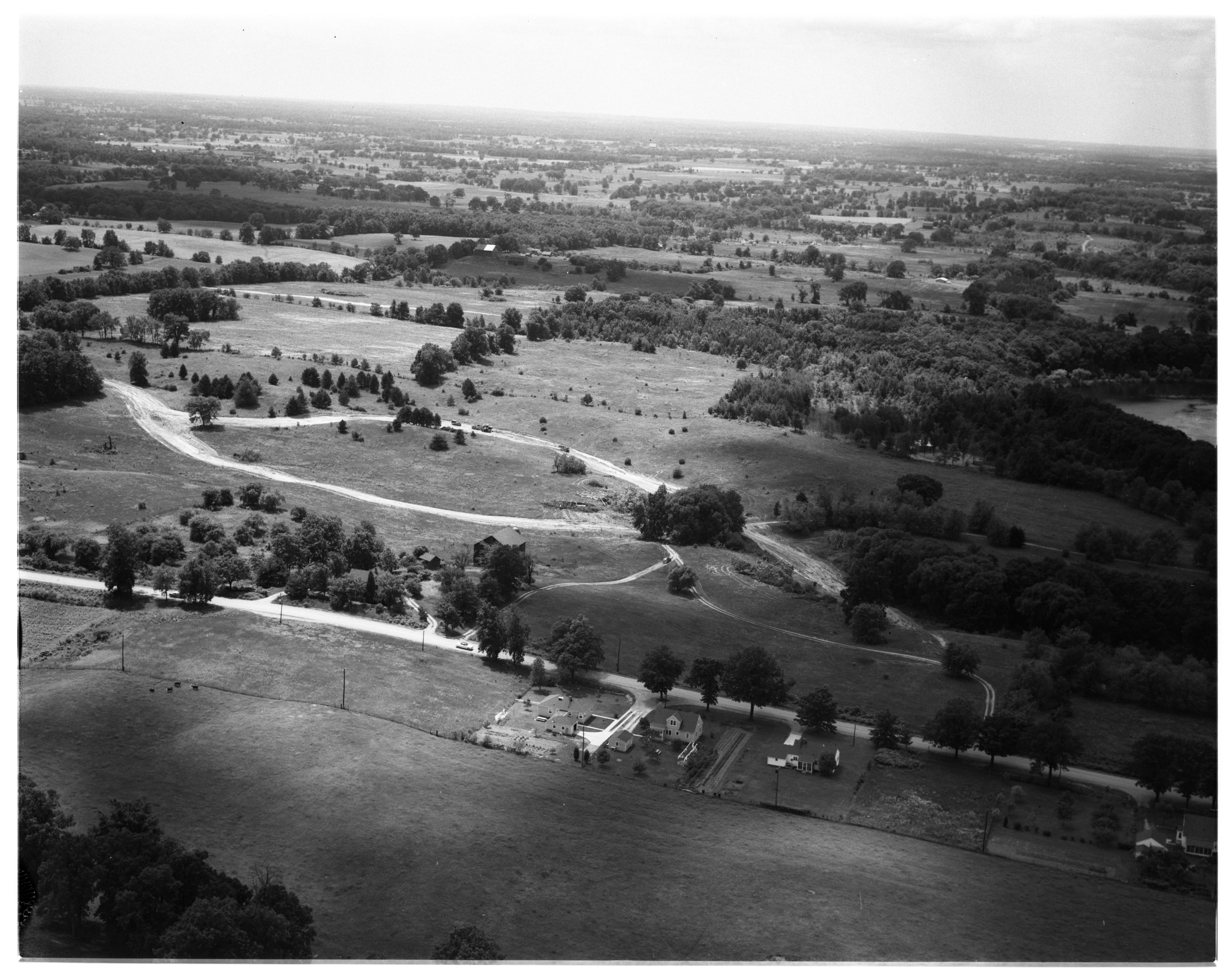
Activity in Scio: A portion of Scio township land is being developed for new homes in what is called Huron Heights subdivision. Maple Rd. cuts across this aerial photograph near the bottom as it divides Scio township (to the top of it) and Ann Arbor township (to the bottom of it). Land under development is just above maple Rd. Dirt roads shown cut through the fields form the subdivision streets. They follow natural valleys at the base of hills upon which future homes are expected to be built. This subdivision, platted into 59 lots, each an acre or more in size, extends north to overlook the W. Huron River Dr. and the river (extreme right and not shown). The farm which fronts Maple Rd. on the Scio township side belongs to James B. Craig.
Ann Arbor News, July 14, 1956
Caption:
Activity in Scio: A portion of Scio township land is being developed for new homes in what is called Huron Heights subdivision. Maple Rd. cuts across this aerial photograph near the bottom as it divides Scio township (to the top of it) and Ann Arbor township (to the bottom of it). Land under development is just above maple Rd. Dirt roads shown cut through the fields form the subdivision streets. They follow natural valleys at the base of hills upon which future homes are expected to be built. This subdivision, platted into 59 lots, each an acre or more in size, extends north to overlook the W. Huron River Dr. and the river (extreme right and not shown). The farm which fronts Maple Rd. on the Scio township side belongs to James B. Craig.
Copyright
Copyright Protected