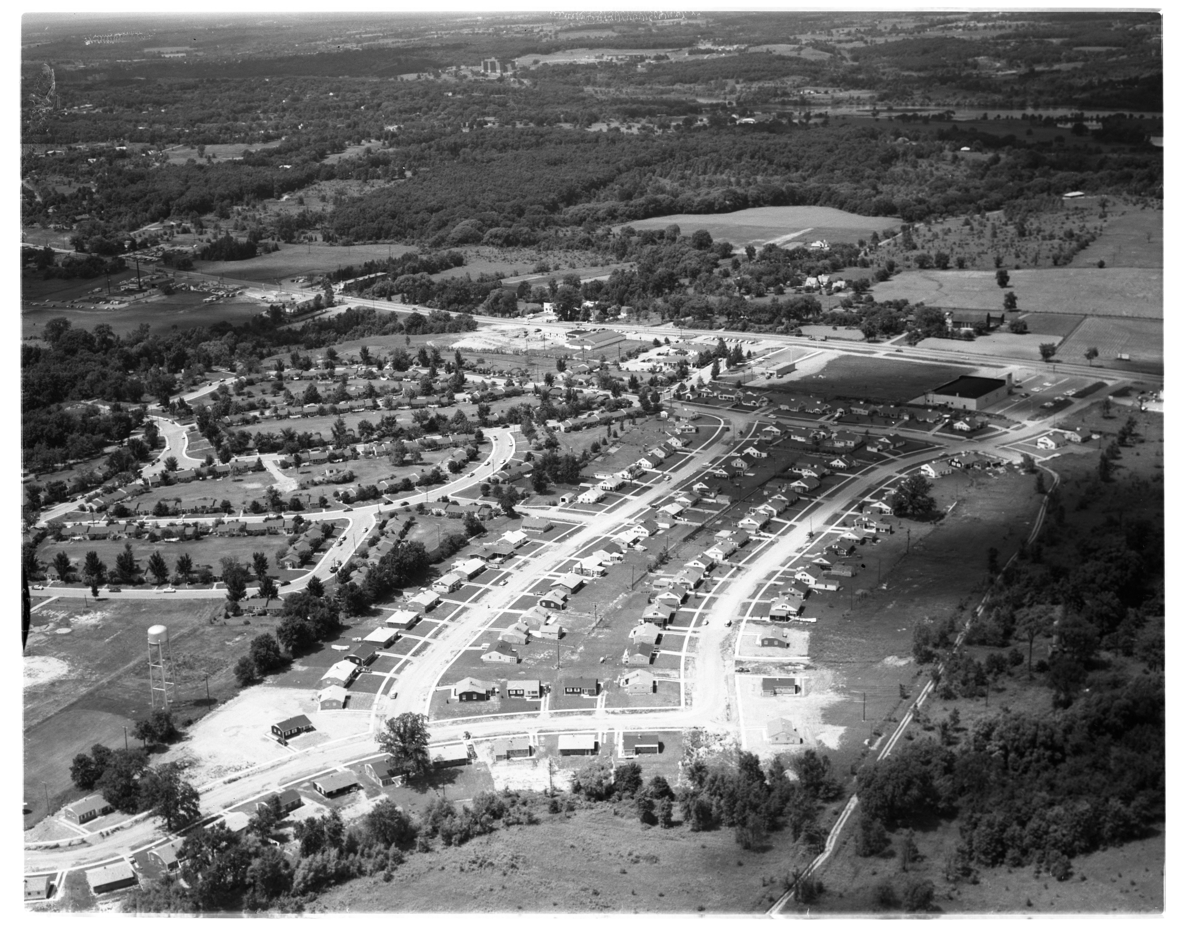
Aerial View of Fritz School Area and Fairgrounds (Future Veterans Memorial Park), October 1951

Year:
1951
Published In:
Ann Arbor News, November 21, 1951
Caption:
EXPANSION TO THE WEST: Graveled Maple Rd. (running diagonally across picture) may become a city street in the not-too-distant future. Growth to date can be seen in this Ann Arbor News aerial photograph. Home Realty Co.'s 100-home Arbor Heights subdivision No. 2 (at upper left) is under construction Fritz School to right of Maple Rd. (near center of picture) has already been taken into the city school district (June, 1949). The Ann Arbor Board of Education anticipating continued growth bought a ten-acre site last June for a proposed 18-20 room elementary school. The site includes open fields (left edge of picture) and part of wooded area. The fairgrounds (at upper right) may be a community recreation center if City Council plans to buy it are carried out.
Copyright
Copyright Protected
Aerial View of Ann Arbor Argus Plant, August 1950
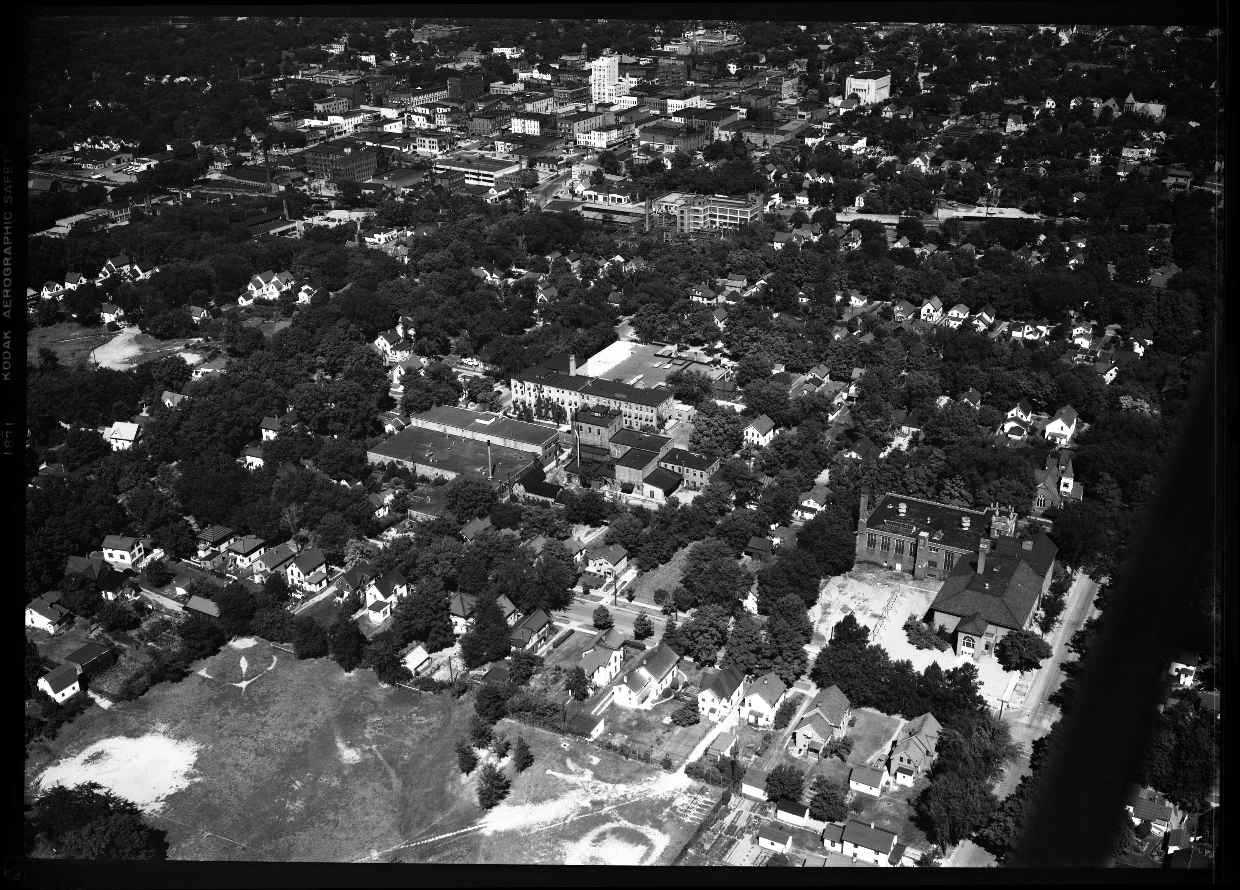
Year:
1950
Copyright
Copyright Protected
- Read more about Aerial View of Ann Arbor Argus Plant, August 1950
- Log in or register to post comments
Aerial View of Downtown Ann Arbor, Looking Southeast, April 1950
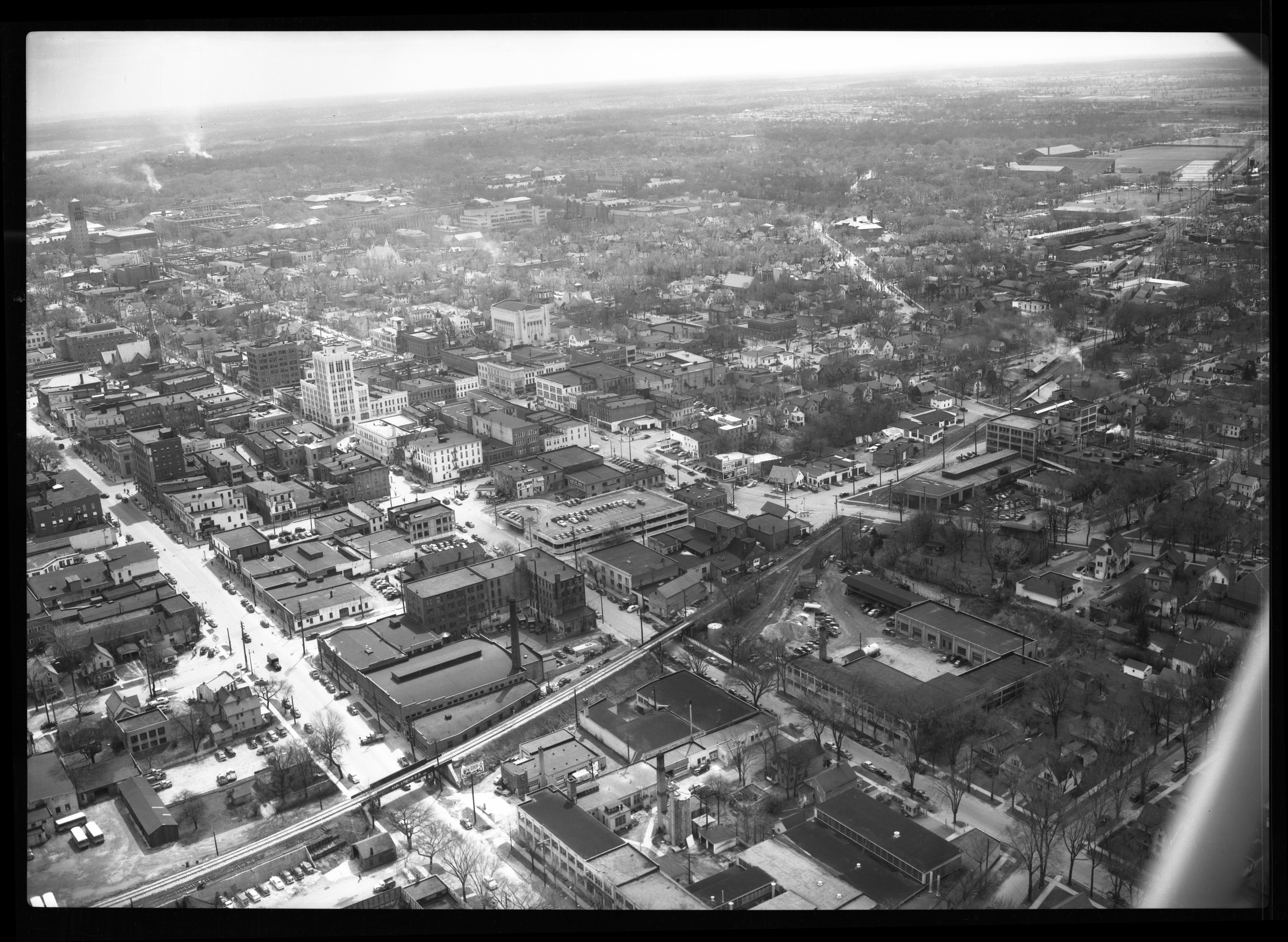
Year:
1950
Copyright
Copyright Protected
Aerial View of South Quadrangle Dormitory, Looking Northwest, March 1951

Year:
1951
Copyright
Copyright Protected
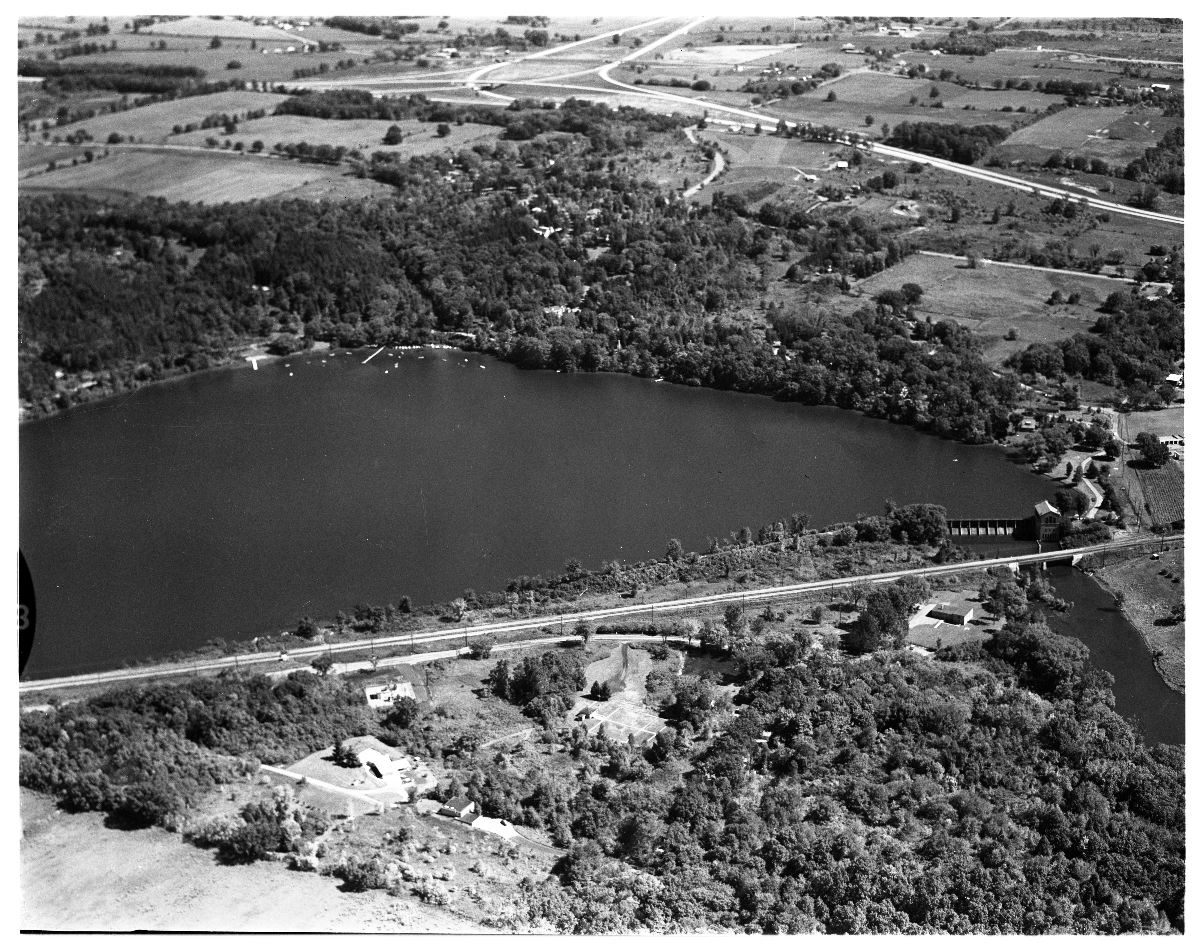
Aerial View of Geddes Pond and Concordia College, September 1963
Year:
1963
Copyright
Copyright Protected
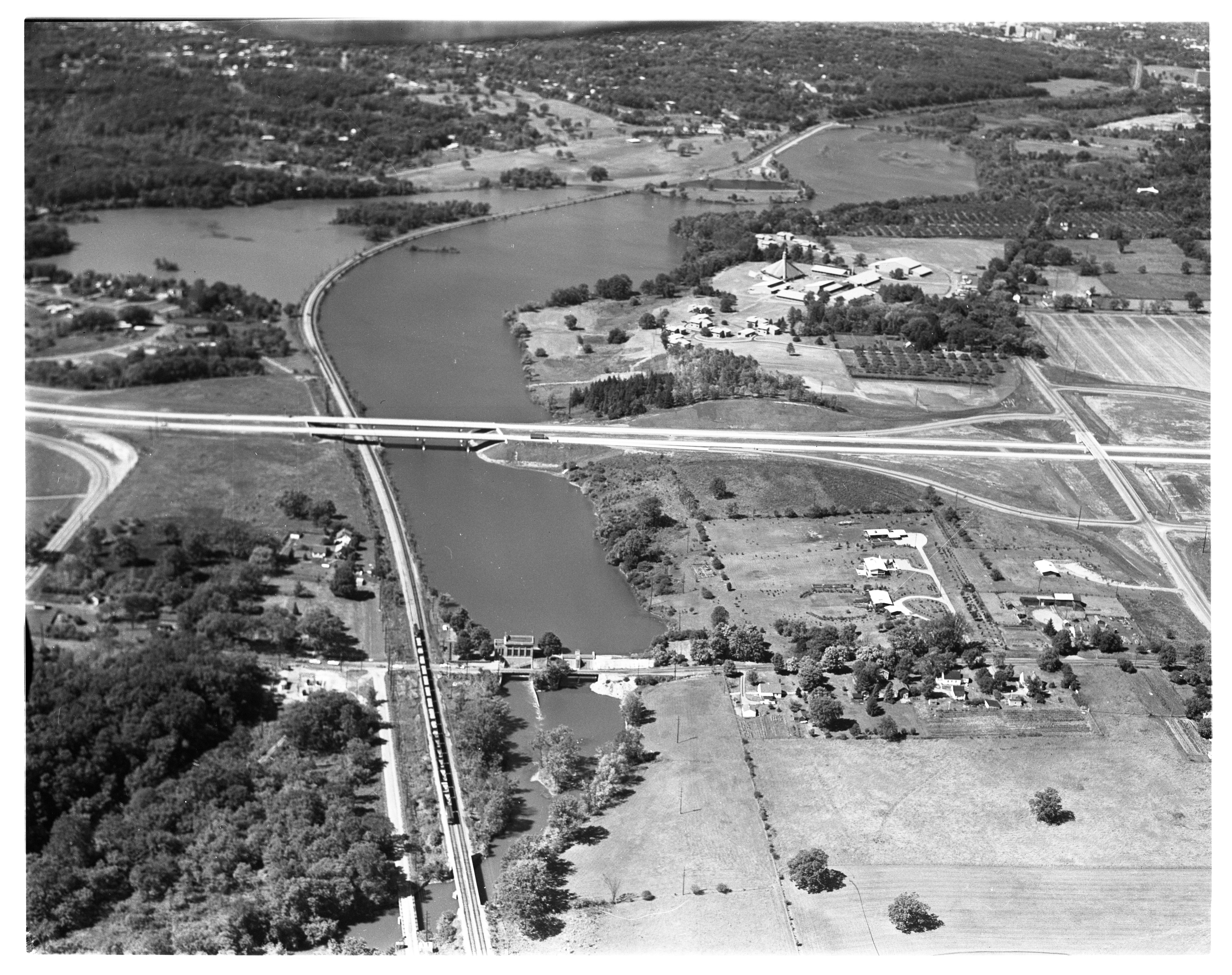
Aerial View of Barton Pond and Dam, September 1963
Year:
1963
Published In:
Ann Arbor News, September 24, 1963
Caption:
Under City Ownership: These two ponds are part of the Detroit Edison Company's Huron River properties that have come under city ownership. The recent purchase, at a cost to Ann Arbor of $280,000, was made to protect the city's main water supply and to provide for recreation and open space. Barton Pond is shown in the lower picture with the Barton Dam at the right. US-23 is at the top right.
Copyright
Copyright Protected
- Read more about Aerial View of Barton Pond and Dam, September 1963
- Log in or register to post comments
Aerial View of the University of Michigan's North Campus, September 1962

Year:
1962
Copyright
Copyright Protected
Aerial View of Pittsfield Village and Pittsfield Park, East Ann Arbor, July 1956
Year:
1956
Copyright
Copyright Protected
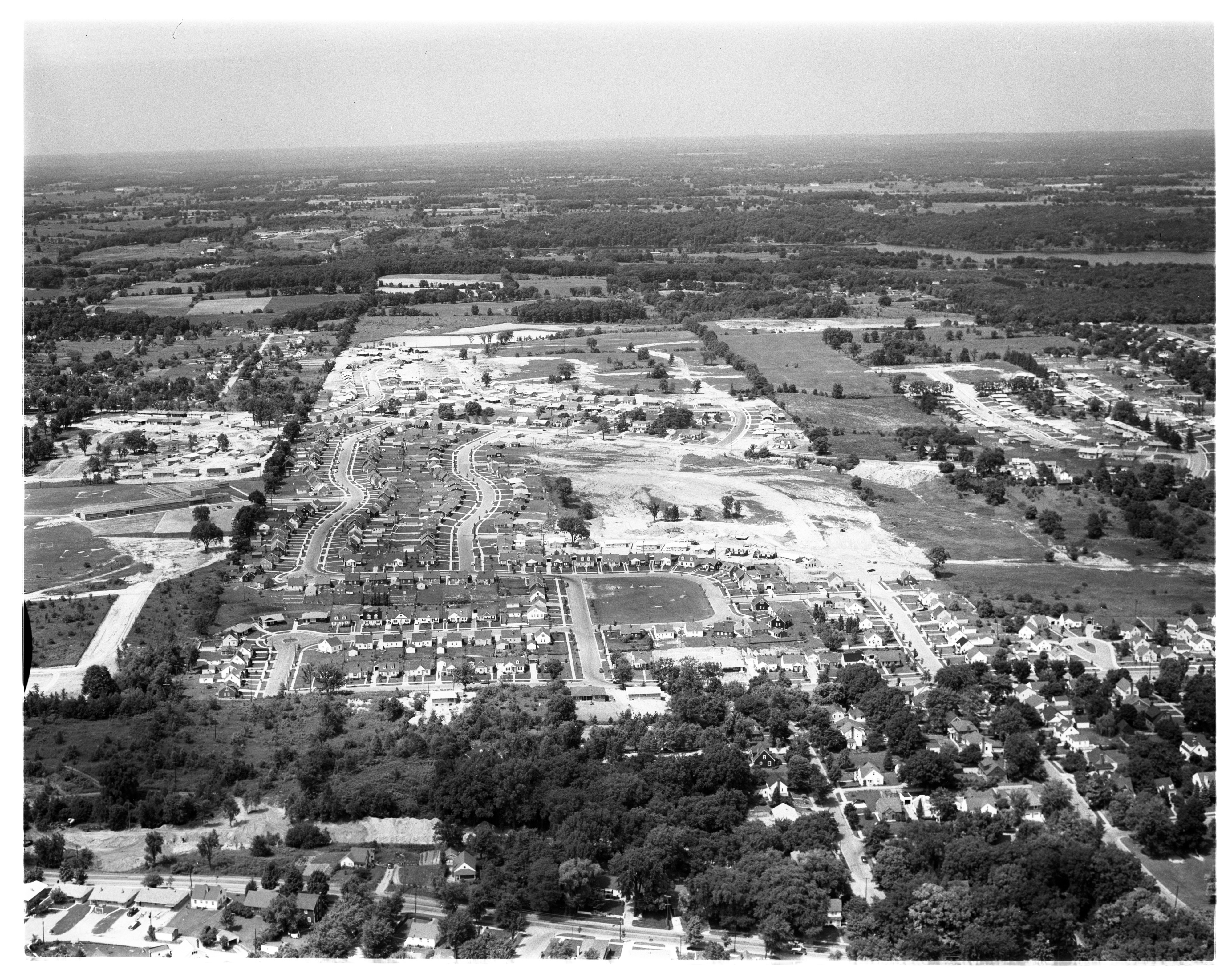
Aerial View of Westaire and Arbor Heights Subdivisions, July 1956
Year:
1956
Published In:
Ann Arbor News, July 7, 1956
Caption:
Growing Northwest: The northwest area of Ann Arbor is partially seen in this aerial photo as an area of new homes. Haisley School (left, center) is flanked by the newly started Westaire subdivisions. The street leading from the school extends to Duncan St., which with its parallel Bruce St., constitutes Arbor Heights No. 2. The dirt area at the right is Arbor Heights No. 3. The original Arbor Heights is at the bottom left. Bruce and Duncan Sts., at their top portion, reach Miller Ave. Above this Martin Acres Nos. 1 and 2. These end at the pond near the top of the picture.
Copyright
Copyright Protected
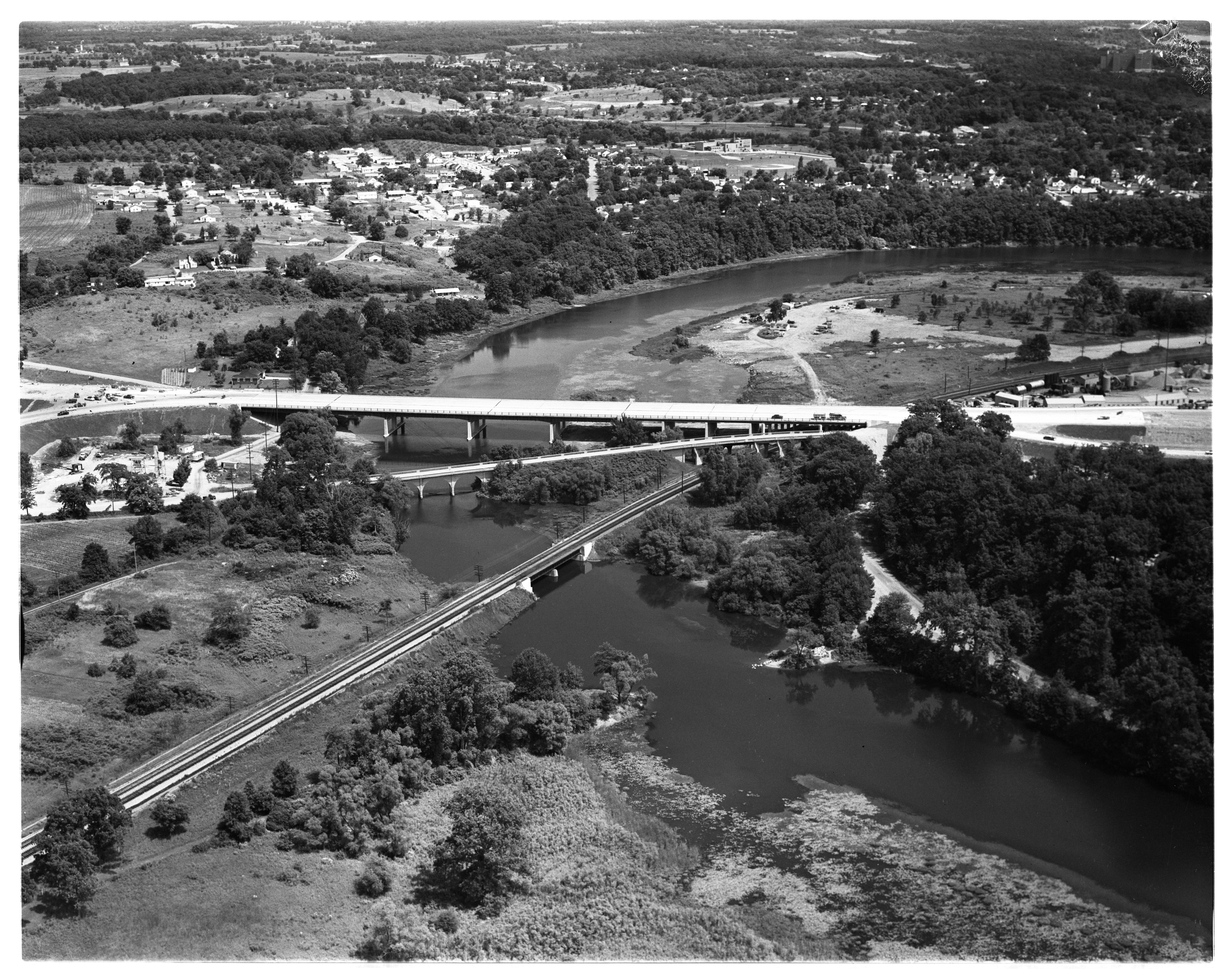
Aerial View of Huron Valley Bridge, July 1956 Photographer: James Galbraith
Year:
1956
Published In:
Ann Arbor News, July 6, 1956
Caption:
BEAUTIFUL BRIDGE: Now providing a lovely entrance-way into Ann Arbor from the north, the new Huron Valley Bride is in full use carrying traffic over the Huron River and the New York Central Railroad tracks. In this aerial view, looking almost due east, the new four-lane span dwarfs the old, narrow Whitemore Lake Rd. Bridge. Faintly visible at top center is the Northside School. (Photo by James Galbraith)
Copyright
Copyright Protected
- Read more about Aerial View of Huron Valley Bridge, July 1956
- Log in or register to post comments