Cindy Donahey and Andrew Richards Repair Windmill, June 1984 Photographer: Cecil Lockard

Year:
1984
Published In:
Ann Arbor News, June 6, 1984
Caption:
ENERGY AT WORK -- The windmill of Project Grow is pumping water again. Broken sine last year, the windmill on Maple Road near M-14 was repaired recently by Cindy Donahey, left, director of the program, and volunteer Andrew Richards. Another volunteer repairman, Robert Eckstein, is not pictured. Schlenke Hardware custom-made a replacement part for the mill, which pumps water storage tanks for gardeners. Project Grow offers gardens to the public at 13 sites in the Ann Arbor-Ypsilanti area. Plots are still available. For information, call 996-3169 between 9 a.m.-1 p.m.
Copyright
Copyright Protected
Project Grow Garden Tour, July 1975 Photographer: Robert Chase
Year:
1975
Published In:
Ann Arbor News, July 27, 1975
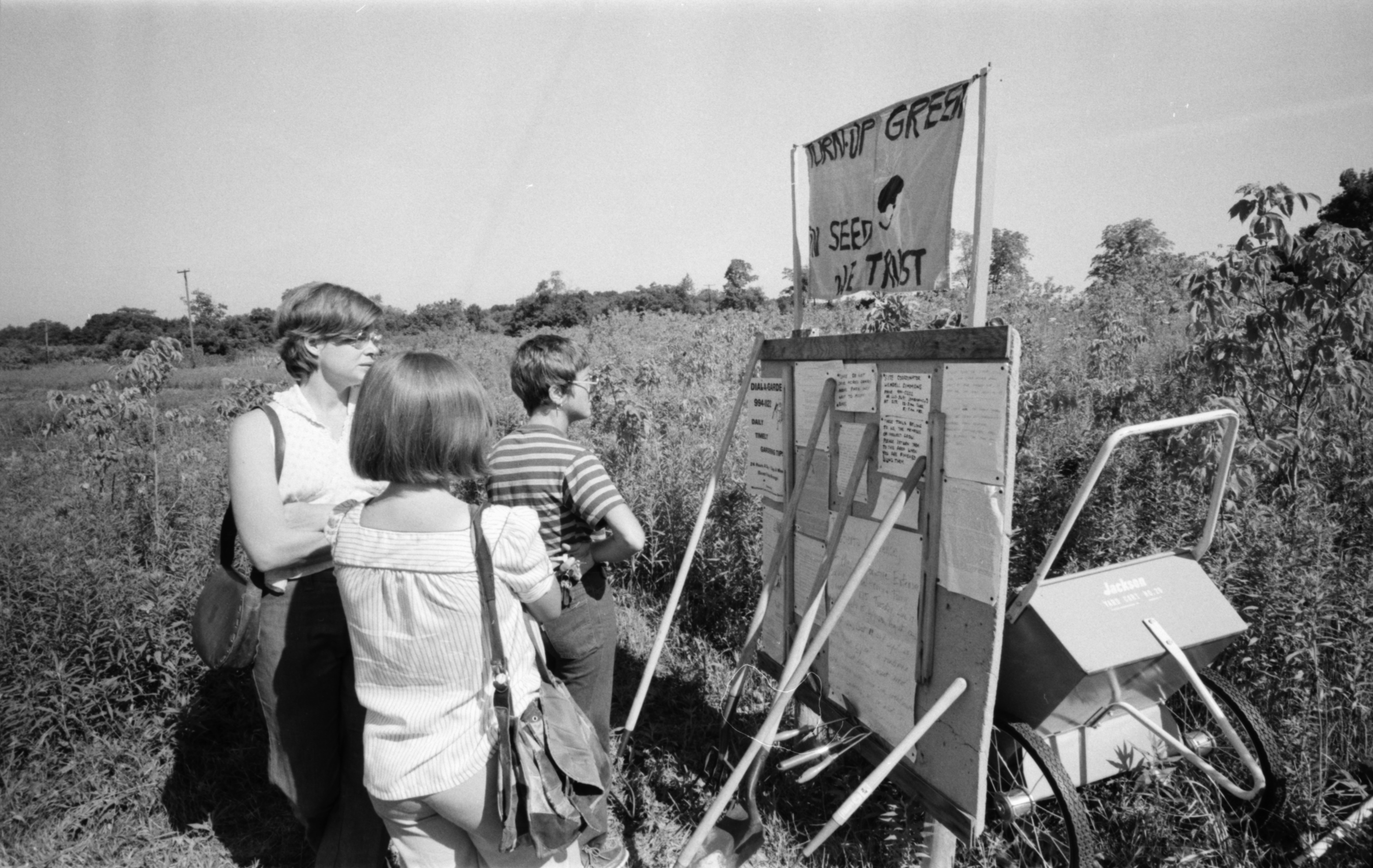
Caption:
'Turn-Up Green . . . In Seed We Trust' says sign which greets visitors to Project Grow site at Maple Road and M-14.
Ann Arbor News, July 27, 1975
Caption:
'Turn-Up Green . . . In Seed We Trust' says sign which greets visitors to Project Grow site at Maple Road and M-14.
Copyright
Copyright Protected
- Read more about Project Grow Garden Tour, July 1975
- Log in or register to post comments
Energy at Work

Parent Issue
Day
6
Month
June
Year
1984
Copyright
Copyright Protected
- Read more about Energy at Work
- Log in or register to post comments
What Project GROW Needs is More Land

Parent Issue
Day
21
Month
April
Year
1974
Copyright
Copyright Protected
- Read more about What Project GROW Needs is More Land
- Log in or register to post comments
Westaire Subdivision Development, July 1956
Year:
1956
Published In:
Ann Arbor News, July 21, 1956
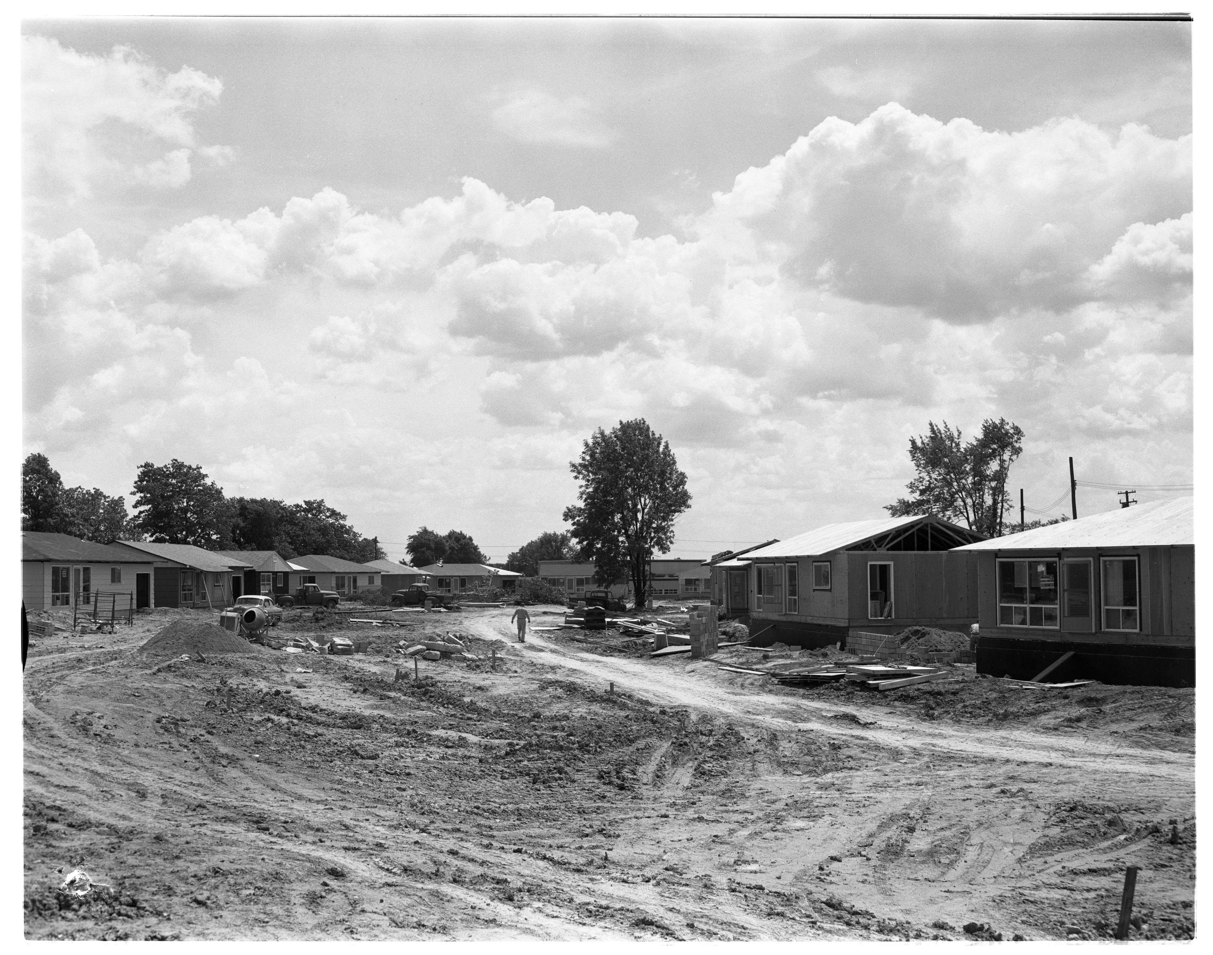
Caption:
The Rough Stage: Now in the rough, raw building stage - that describes Westaire subdivision, now teeming with construction activity in the city's northwest area. This is S. Circle Dr., a new street which starts at Miller Ave. west of Arbor Heights subdvision and curves past Haisley School to Maple Rd. That's Haisley School in the background. There are a part of 68 homes being built by the Prospect Hill Construction Co.
Ann Arbor News, July 21, 1956
Caption:
The Rough Stage: Now in the rough, raw building stage - that describes Westaire subdivision, now teeming with construction activity in the city's northwest area. This is S. Circle Dr., a new street which starts at Miller Ave. west of Arbor Heights subdvision and curves past Haisley School to Maple Rd. That's Haisley School in the background. There are a part of 68 homes being built by the Prospect Hill Construction Co.
Copyright
Copyright Protected
- Read more about Westaire Subdivision Development, July 1956
- Log in or register to post comments
Aerial Photograph of Huron Heights Subdivision Development, July 1956
Year:
1956
Published In:
Ann Arbor News, July 14, 1956
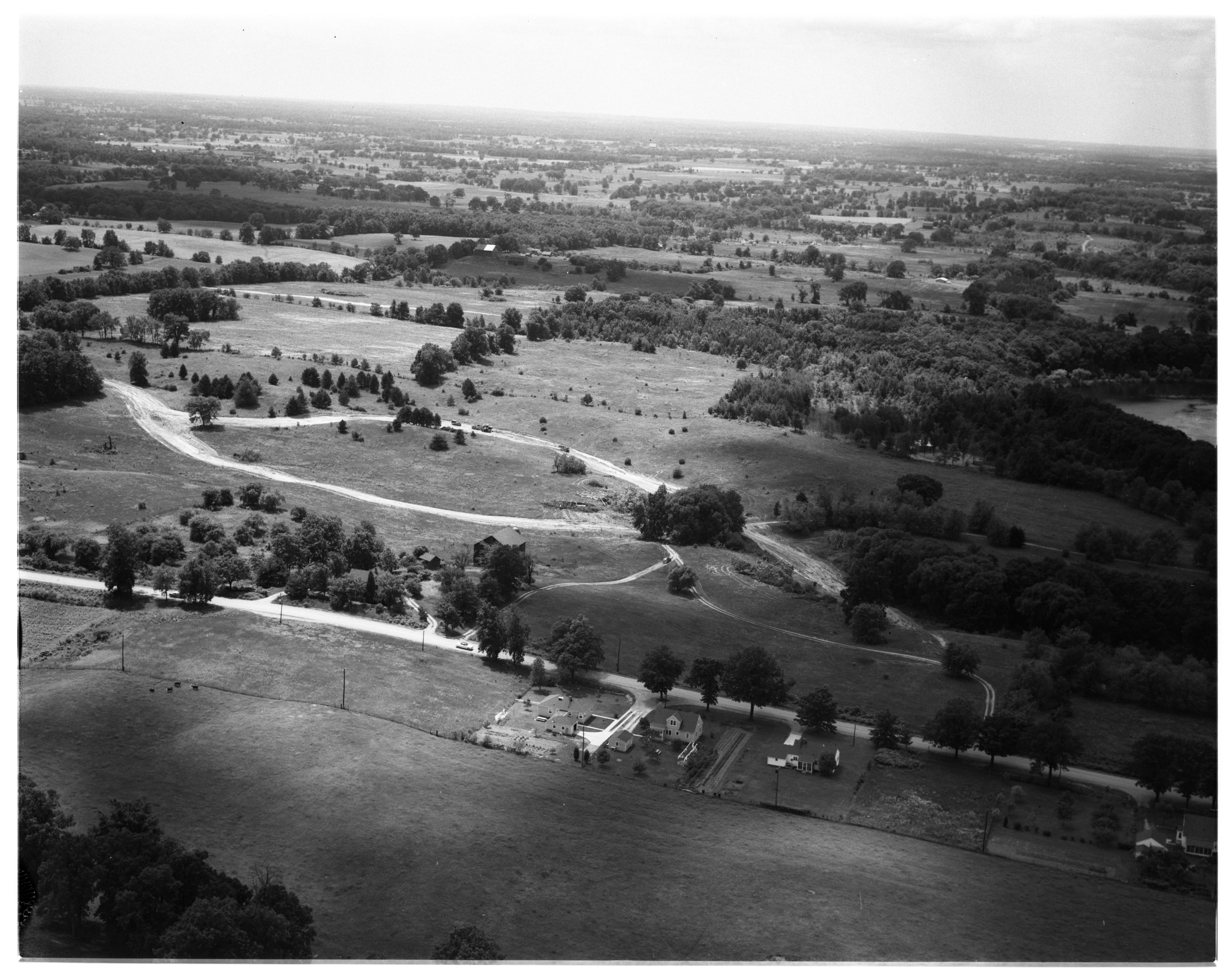
Caption:
Activity in Scio: A portion of Scio township land is being developed for new homes in what is called Huron Heights subdivision. Maple Rd. cuts across this aerial photograph near the bottom as it divides Scio township (to the top of it) and Ann Arbor township (to the bottom of it). Land under development is just above maple Rd. Dirt roads shown cut through the fields form the subdivision streets. They follow natural valleys at the base of hills upon which future homes are expected to be built. This subdivision, platted into 59 lots, each an acre or more in size, extends north to overlook the W. Huron River Dr. and the river (extreme right and not shown). The farm which fronts Maple Rd. on the Scio township side belongs to James B. Craig.
Ann Arbor News, July 14, 1956
Caption:
Activity in Scio: A portion of Scio township land is being developed for new homes in what is called Huron Heights subdivision. Maple Rd. cuts across this aerial photograph near the bottom as it divides Scio township (to the top of it) and Ann Arbor township (to the bottom of it). Land under development is just above maple Rd. Dirt roads shown cut through the fields form the subdivision streets. They follow natural valleys at the base of hills upon which future homes are expected to be built. This subdivision, platted into 59 lots, each an acre or more in size, extends north to overlook the W. Huron River Dr. and the river (extreme right and not shown). The farm which fronts Maple Rd. on the Scio township side belongs to James B. Craig.
Copyright
Copyright Protected
Swimmers Stand Atop The Foster Bridge, July 1955

Year:
1955
Published In:
Ann Arbor News, July 9, 1955
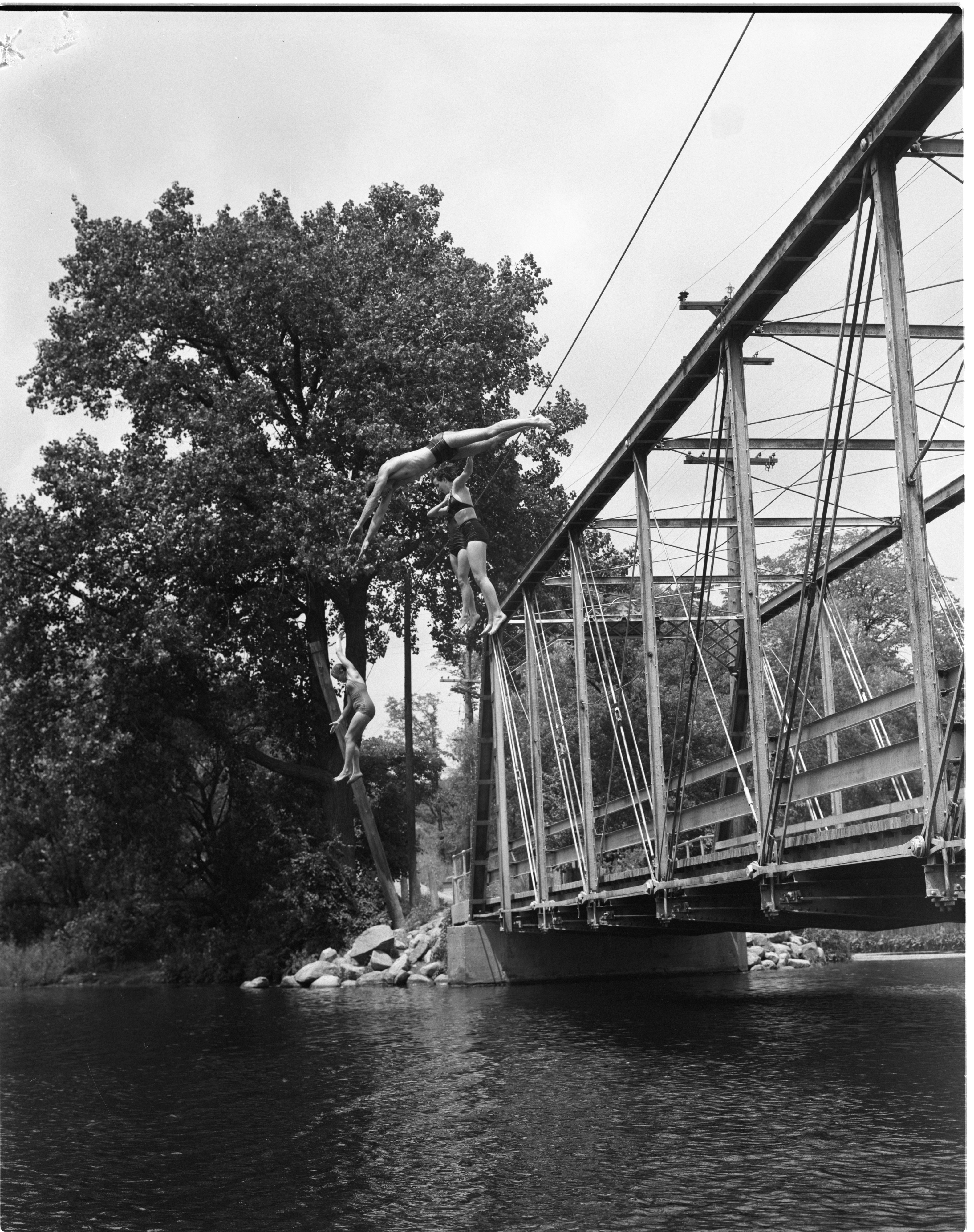
Caption:
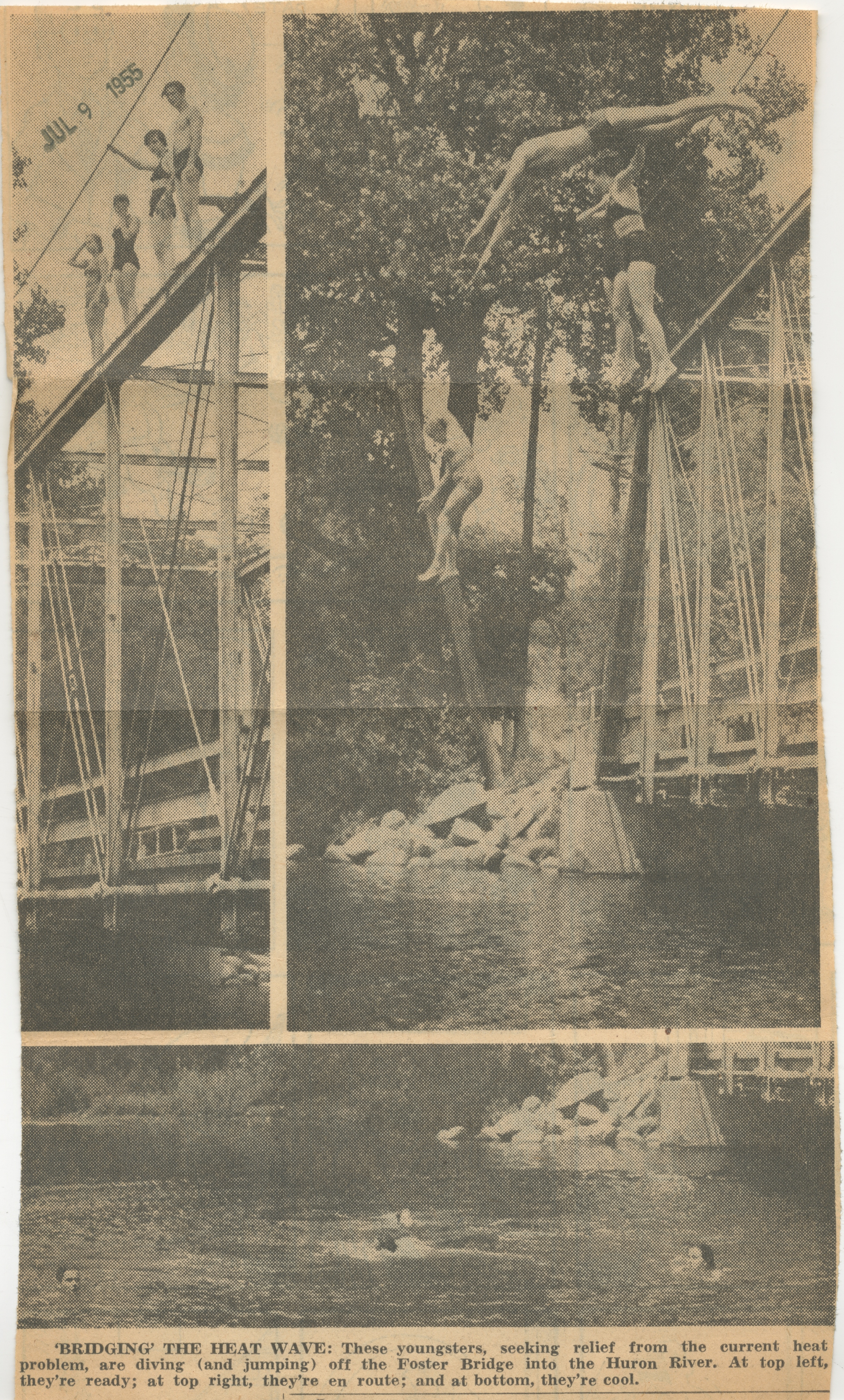
'BRIDGING' THE HEAT WAVE: These youngsters, seeking relief from the current heat problem, are diving (and jumping) off the Foster Bridge into the Huron River. At top left, they're ready; at top right, they're en route; and at bottom, they're cool.
Ann Arbor News, July 9, 1955
Caption:
'BRIDGING' THE HEAT WAVE: These youngsters, seeking relief from the current heat problem, are diving (and jumping) off the Foster Bridge into the Huron River. At top left, they're ready; at top right, they're en route; and at bottom, they're cool.
Copyright
Copyright Protected
- Read more about Swimmers Stand Atop The Foster Bridge, July 1955
- Log in or register to post comments
Swimmers Jump Off The Foster Bridge, July 1955
Year:
1955
Published In:
Ann Arbor News, July 9, 1955
Caption:
'BRIDGING' THE HEAT WAVE: These youngsters, seeking relief from the current heat problem, are diving (and jumping) off the Foster Bridge into the Huron River. At top left, they're ready; at top right, they're en route; and at bottom, they're cool.
Ann Arbor News, July 9, 1955
Caption:
'BRIDGING' THE HEAT WAVE: These youngsters, seeking relief from the current heat problem, are diving (and jumping) off the Foster Bridge into the Huron River. At top left, they're ready; at top right, they're en route; and at bottom, they're cool.
Copyright
Copyright Protected
- Read more about Swimmers Jump Off The Foster Bridge, July 1955
- Log in or register to post comments
Swimming In The Huron River At The Foster Bridge, July 1955

Year:
1955
Published In:
Ann Arbor News, July 9, 1955
Caption:
'BRIDGING' THE HEAT WAVE: These youngsters, seeking relief from the current heat problem, are diving (and jumping) off the Foster Bridge into the Huron River. At top left, they're ready; at top right, they're en route; and at bottom, they're cool.
Ann Arbor News, July 9, 1955
Caption:
'BRIDGING' THE HEAT WAVE: These youngsters, seeking relief from the current heat problem, are diving (and jumping) off the Foster Bridge into the Huron River. At top left, they're ready; at top right, they're en route; and at bottom, they're cool.
Copyright
Copyright Protected
'Bridging' The Heat Wave
Parent Issue
Day
9
Month
July
Year
1955
Copyright
Copyright Protected
- Read more about 'Bridging' The Heat Wave
- Log in or register to post comments