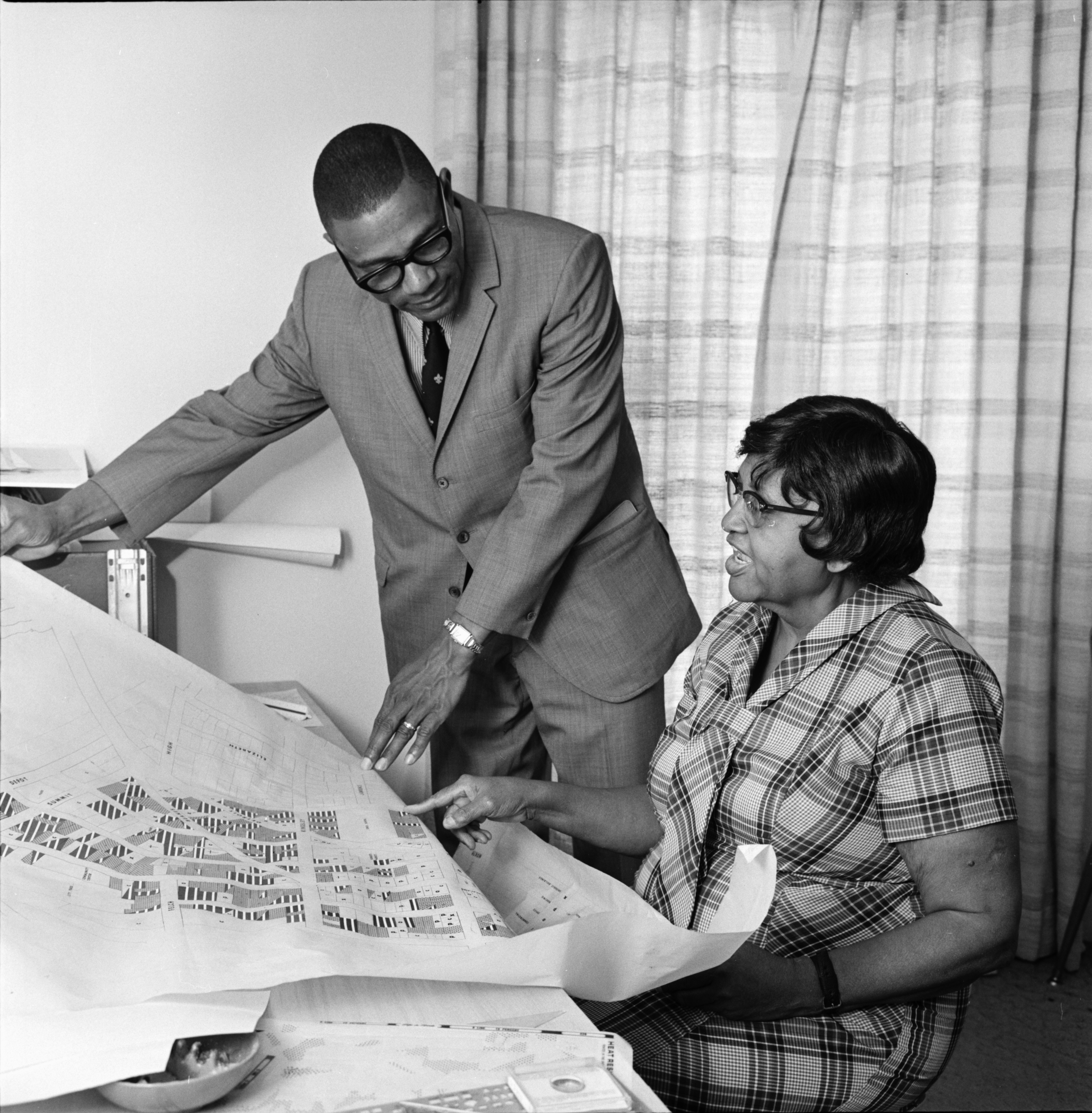
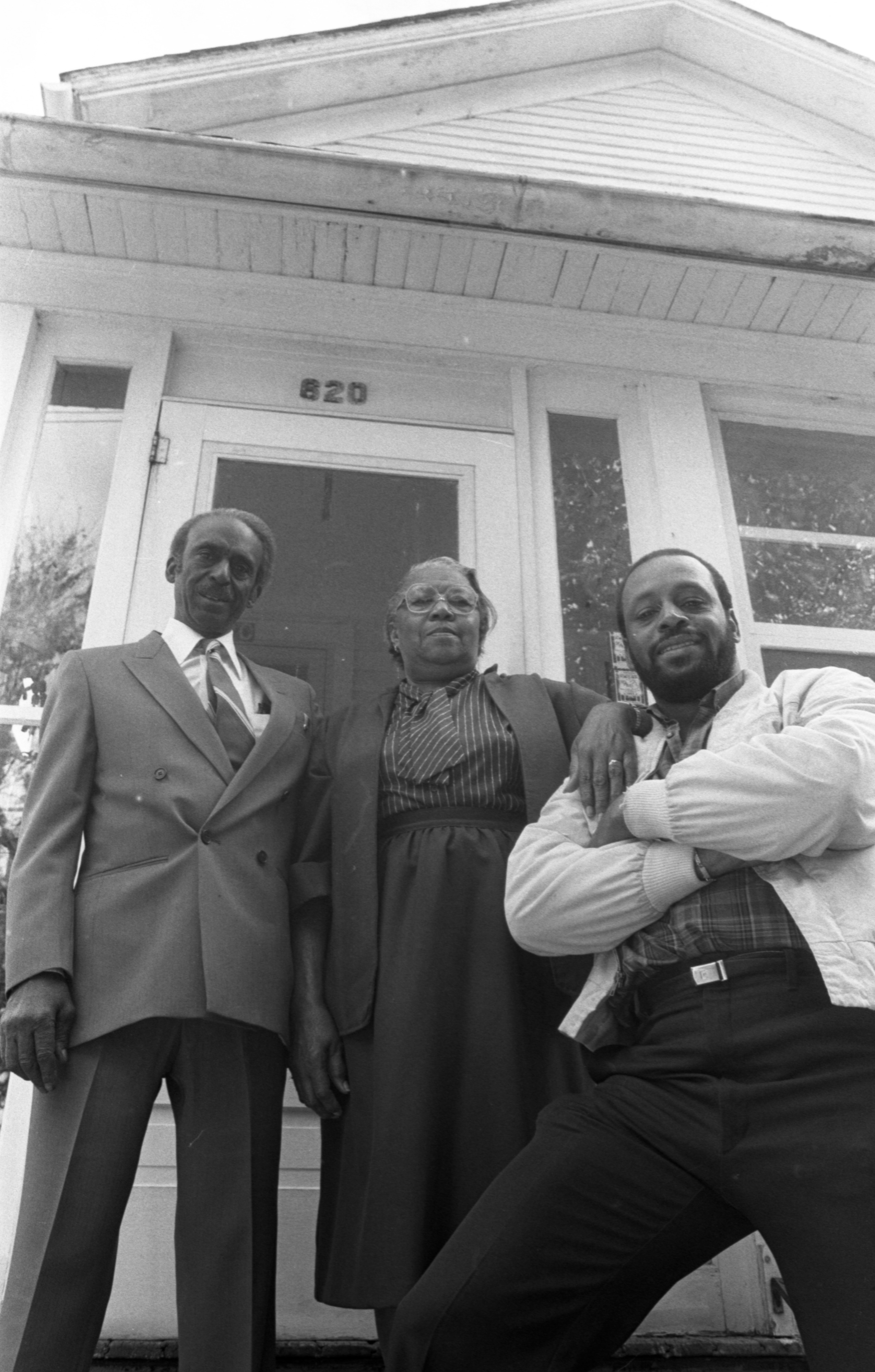
Jesse Hill and Letty Wickliffe Study Housing Map, August 1972 Photographer: Cecil Lockard
Year:
1972
Published In:
Ann Arbor News, August 20, 1972
Caption:
Jesse Hill and Letty Wickliffe Review City Needs At CCE Office
Ann Arbor News, August 20, 1972
Caption:
Jesse Hill and Letty Wickliffe Review City Needs At CCE Office
Copyright
Copyright Protected
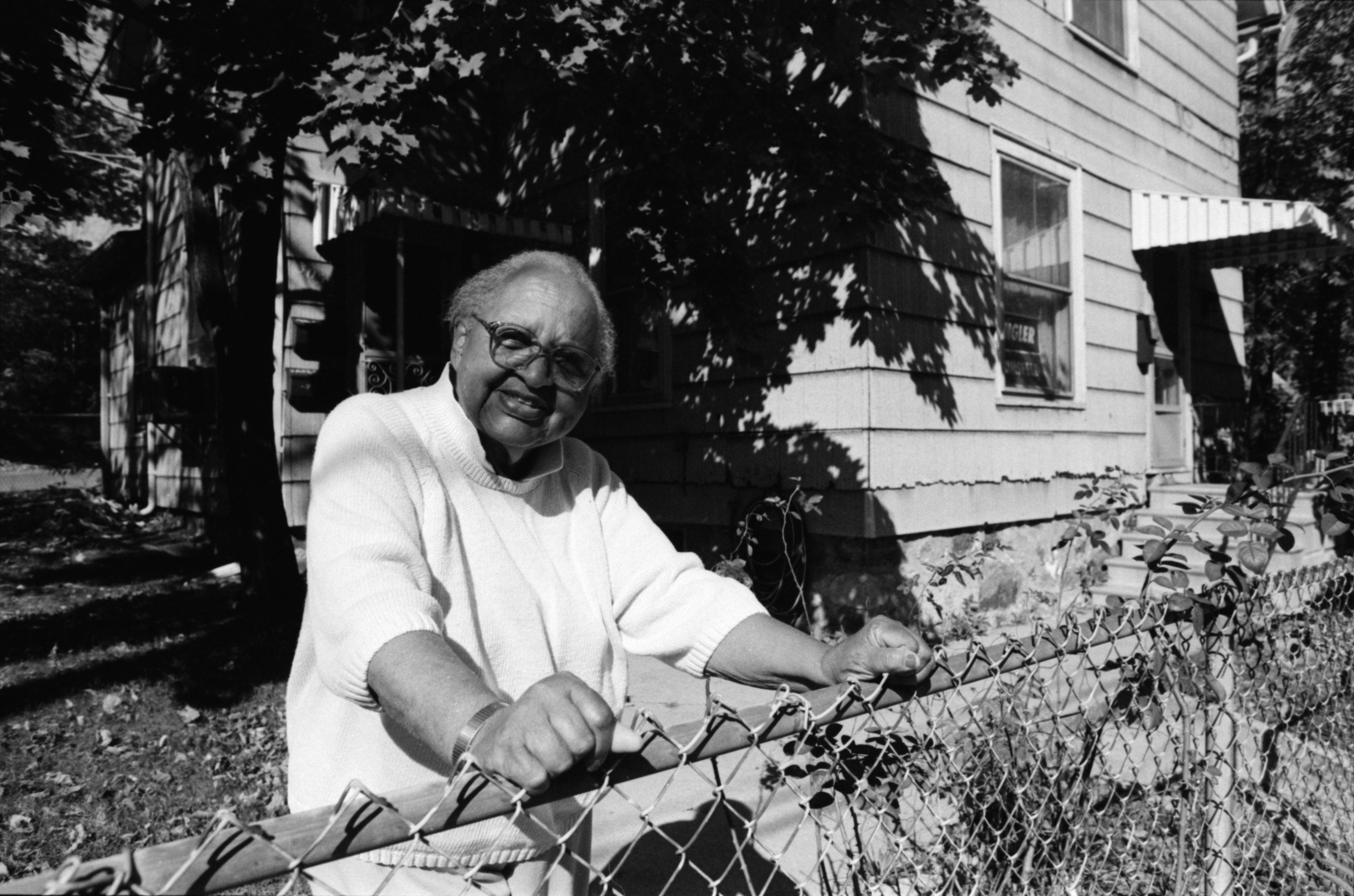
Longtime Beakes Street Homeowner Letty Wickliffe, October 1990 Photographer: Robert Chase
Year:
1990
Published In:
Ann Arbor News, November 18, 1990
Caption:
Letty Wickliffe, outside her home at 305 Beakes.
Ann Arbor News, November 18, 1990
Caption:
Letty Wickliffe, outside her home at 305 Beakes.
Copyright
Copyright Protected
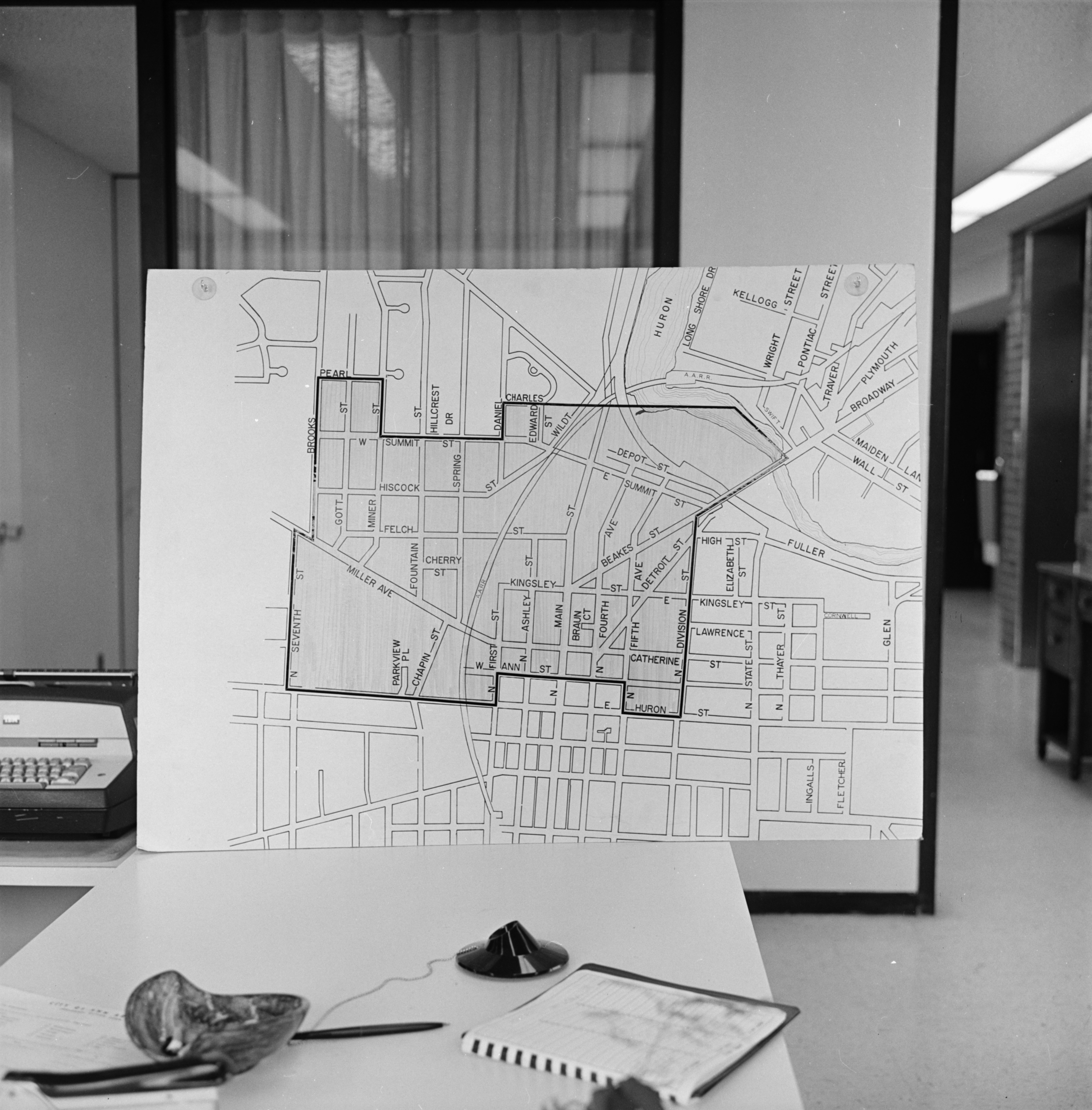
Map of Model Cities Neighborhood, June 1970 Photographer: Jack Stubbs
Year:
1970
Copyright
Copyright Protected
- Read more about Map of Model Cities Neighborhood, June 1970
- Log in or register to post comments
Map of Model Cities Neighborhood Being Displayed, June 1970 Photographer: Jack Stubbs
Year:
1970
Published In:
Ann Arbor News, May 17, 1970
Caption:
The Neighborhood: This map shows the Model Cities Neighborhood with an estimated population in the 4,000 to 4,500 range. Millions of dollars could be poured into the area during the next few years to upgrade it physically and to help residents economically through employment projects. The program is expected to last about five years. A controversy now rages over the Packard-to-Beakes bypass route, with Model Cities representatives objecting to the northern end which would turn Kingsley and Beakes into major thoroughfares and divide the Model Neighborhood. An alternative suggested by Model Cities would be to follow the route of the Ann Arbor Railroad tracks to connect with Main St. near Depot.
Copyright
Copyright Protected
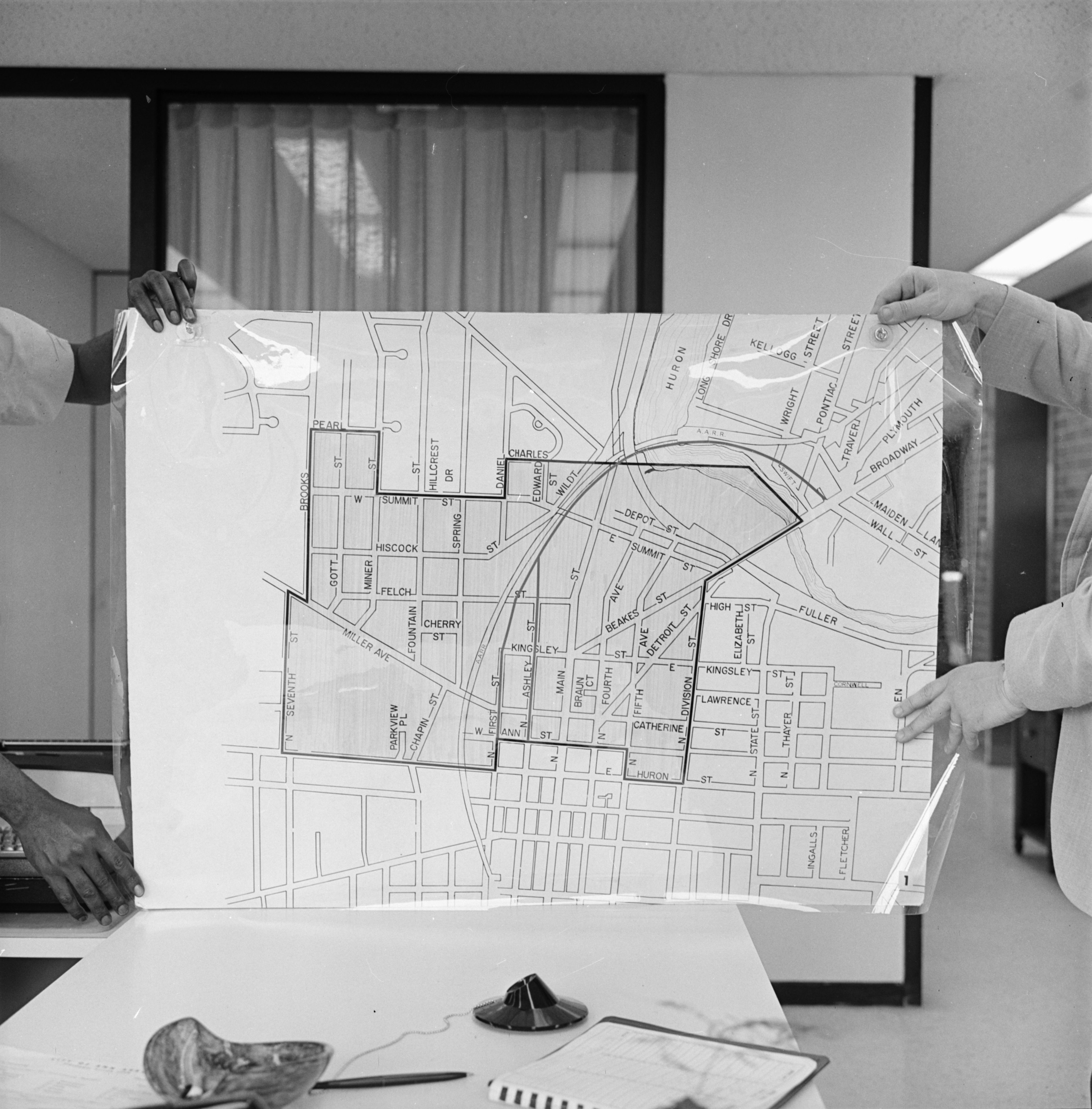
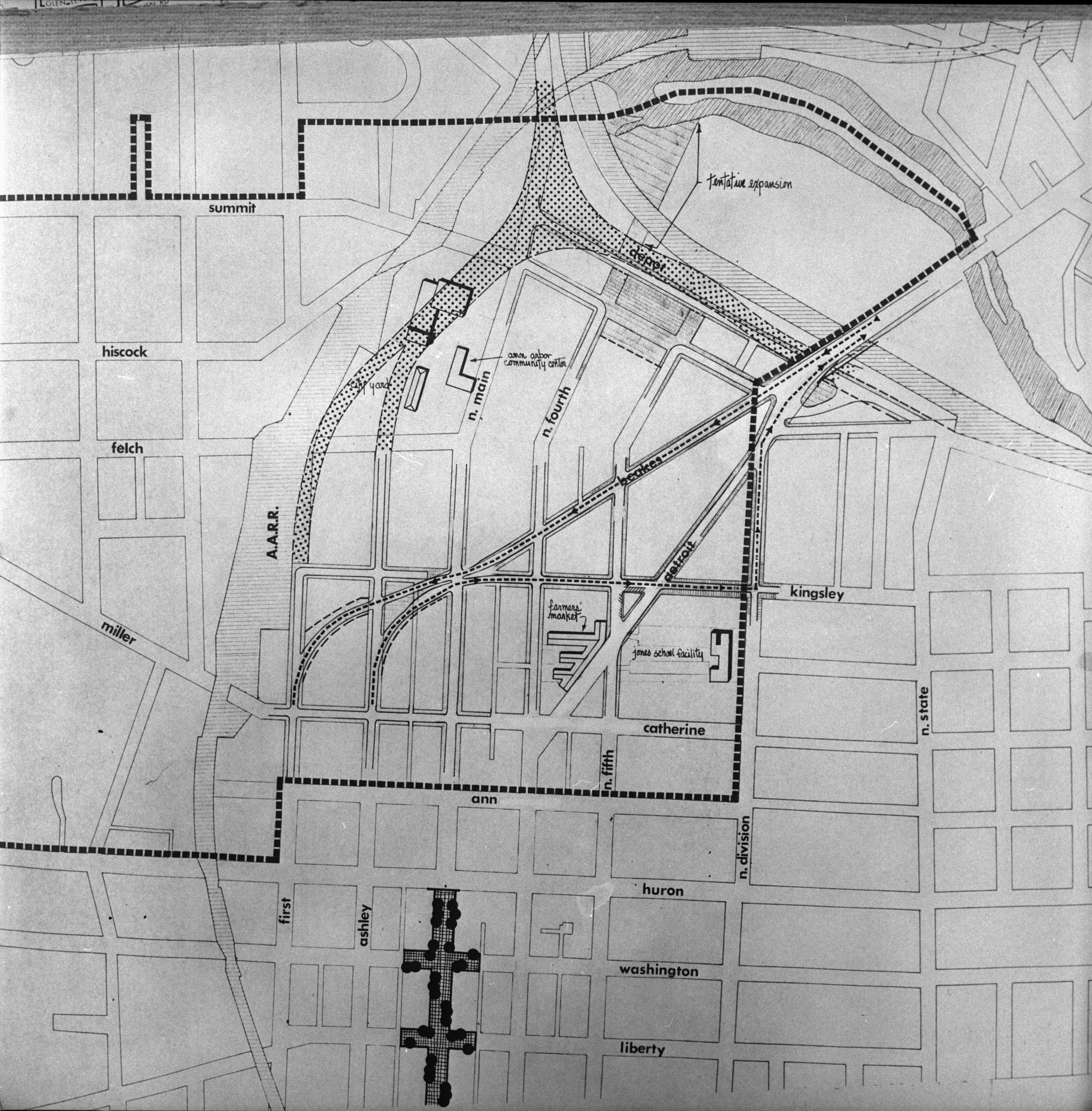
Map of Proposed Packard-Beakes Bypass, February 1972 Photographer: Eck Stanger
Year:
1972
Published In:
Ann Arbor News, February 1, 1972
Caption:
Packard-Beakes Route: This map focuses on the center of the controversial Packard-Beakes bypass, which was approved by City Council last night. It shows the northerly connection with Beakes and Kingsley as one-way pairs, Beakes handling inbound traffic and Kingsley the outbound motorists. Beakes and Kingsley would connect with Ashley and First (at left) which would then connect with Packard south of the Man St. business district. Arrows on the map indicate the traffic pattern which will result when--and if--the bypass is completed. The dotted-in diagram in the upper half of the map is the proposed alternative bypass route proposed by the Model Cities Policy Board, a routing termed too expensive by city officials. The route which was approved was first proposed six years ago. (Story on Page 1)
Copyright
Copyright Protected
- Read more about Map of Proposed Packard-Beakes Bypass, February 1972
- Log in or register to post comments
The Dixon Family Home at 620 North Fourth Avenue, October 1986 Photographer: Larry E. Wright
Year:
1986
Copyright
Copyright Protected
William, Minnie, and their son, Steve Dixon, at their home on Fourth Avenue, October 1986 Photographer: Larry E. Wright
Year:
1986
Published In:
Ann Arbor News, October 20, 1986
Caption:
The Dixon family, William, Minnie and their son Steve, at their long-time residence on Fourth Avenue.
Ann Arbor News, October 20, 1986
Caption:
The Dixon family, William, Minnie and their son Steve, at their long-time residence on Fourth Avenue.
Copyright
Copyright Protected
Neighborhood Residents Gather Around Fallen Tree Limb on West Summit Street, August 1950

Year:
1950
Copyright
Copyright Protected
Boy Crosses West Summit Street Near Railroad Crossing, September 1966 Photographer: Duane Scheel

Year:
1966
Copyright
Copyright Protected
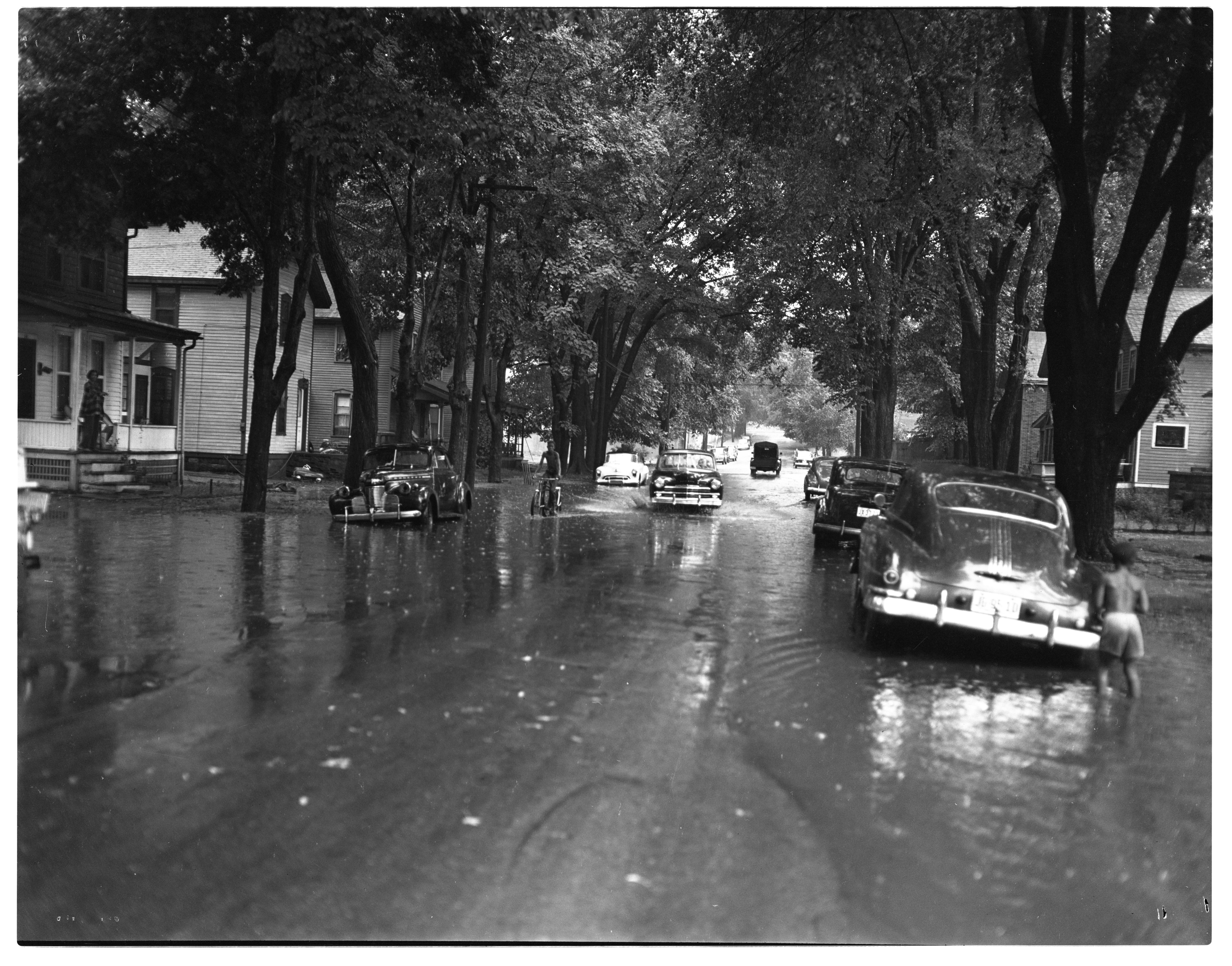
Children Play Despite Flooding on East Summit Street, August 1950
Year:
1950
Published In:
Ann Arbor News, August 11, 1950
Caption:
Yesterday was a very wet day, as this picture of semi-flooded E. Summit St. proves. Here, neighborhood youngsters frolic in the water that covered the street between N. Main St. and N. Fourth Ave. A total of 1.9 inches of rain fell in the severe cloudbursts that lashed the city during the afternoon and evening. Only minor damage was reported, however.
Copyright
Copyright Protected