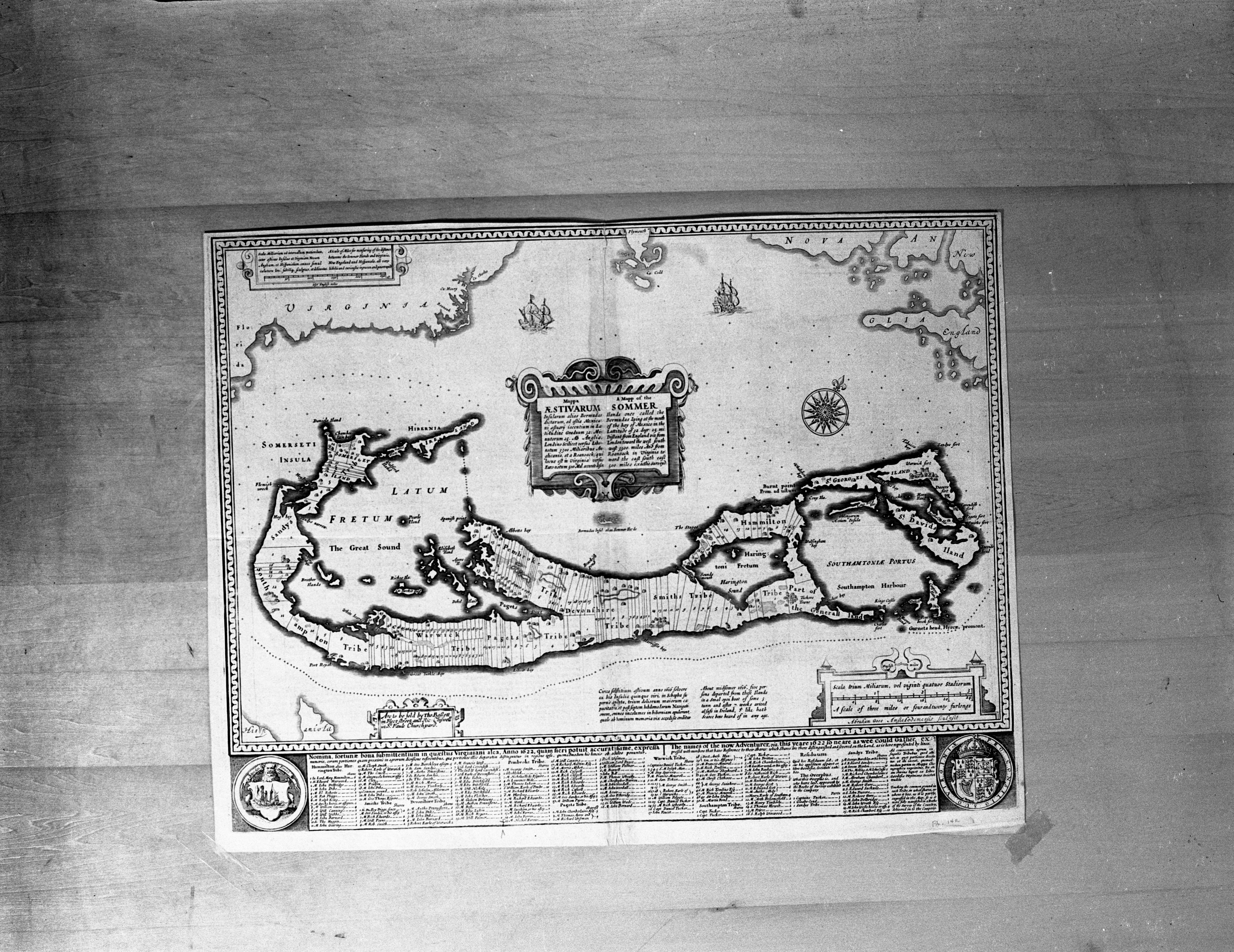
Maps of Naval Bases Acquired From Britain, William Clemens Library, September 1940 Photographer: Eck Stanger

Year:
1940
Copyright
Copyright Protected
Maps of Naval Bases Acquired From Britain, William Clemens Library, September 1940 Photographer: Eck Stanger
Year:
1940
Copyright
Copyright Protected
New Police Map

Parent Issue
Day
22
Month
January
Year
1960
Copyright
Copyright Protected
- Read more about New Police Map
- Log in or register to post comments
William A. Lunk Touches Up Display In Mineralogy Room, May 1962 Photographer: Doug Fulton
Year:
1962
Published In:
Ann Arbor News, May 19, 1962
Caption:
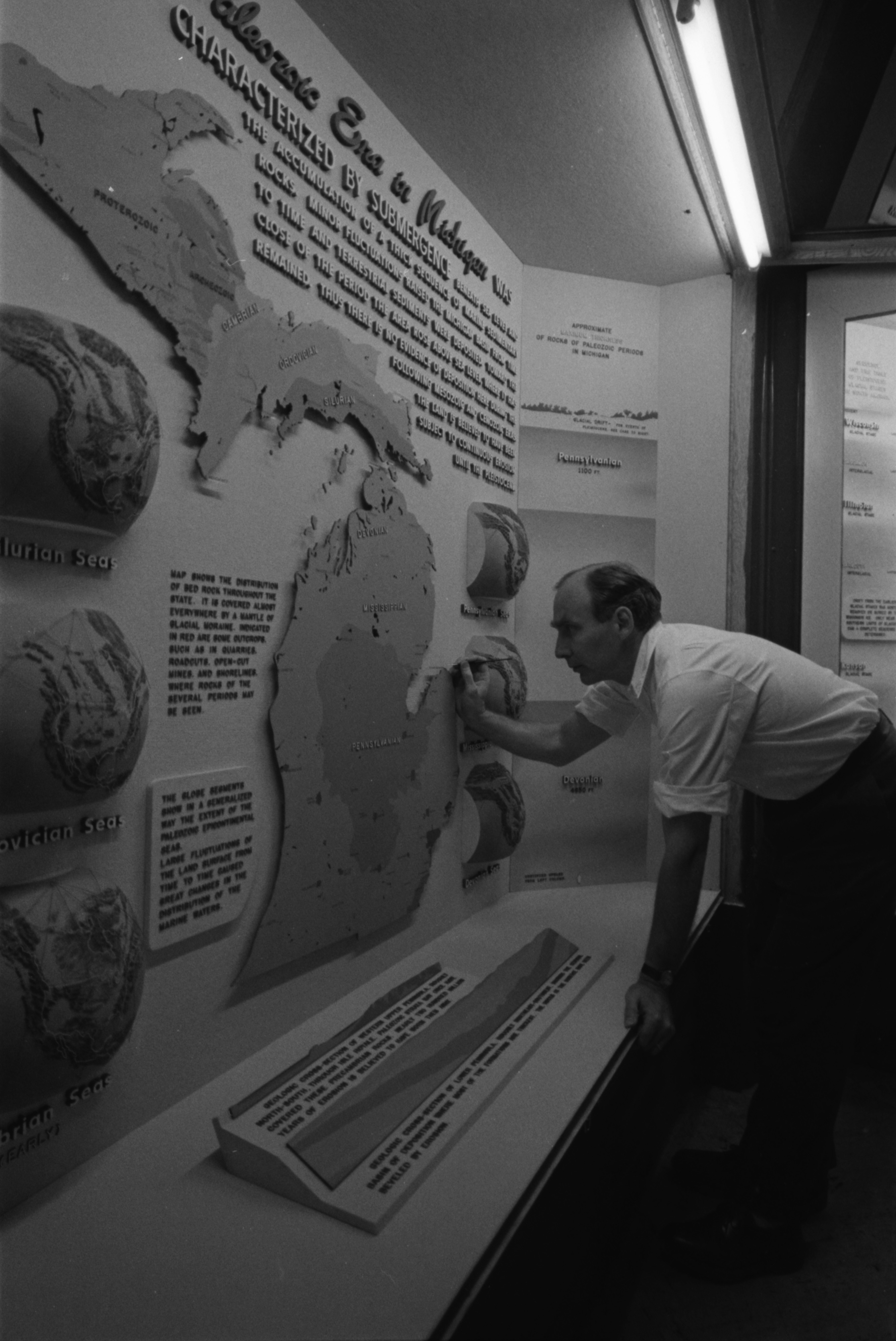
Touch-Up: William A. Lunk, associate curator of exhibits at the University's Exhibit Museum, touches up a display in the mineralogy room showing the changes in prehistoric seas in Michigan and their effect on the state's minerals. Lunk designed and executed the exhibit, including the three-dimensional maps at left and right. Each map was made of plaster with wax contours carefully modeled and painted and topped with a grid of threads to represent latitude and longitude lines. Each took about 10 days to make.
Ann Arbor News, May 19, 1962
Caption:
Touch-Up: William A. Lunk, associate curator of exhibits at the University's Exhibit Museum, touches up a display in the mineralogy room showing the changes in prehistoric seas in Michigan and their effect on the state's minerals. Lunk designed and executed the exhibit, including the three-dimensional maps at left and right. Each map was made of plaster with wax contours carefully modeled and painted and topped with a grid of threads to represent latitude and longitude lines. Each took about 10 days to make.
Copyright
Copyright Protected
Members of U.S. Bureau of Outdoor Recreation Regional Staff Study Great Lakes Water Quality, March 1964 Photographer: Doug Fulton

Year:
1964
Published In:
Ann Arbor News, March 7, 1964
Caption:
River Basin Study: George Webbon, of the U. S. Bureau of Outdoor Recreation regional staff, studies map of the Ohio River watershed. Planning for recreational use of lands surrounding flood-control impoundments is one of the tasks faced by the Ann Arbor staff.
Ann Arbor News, March 7, 1964
Caption:
River Basin Study: George Webbon, of the U. S. Bureau of Outdoor Recreation regional staff, studies map of the Ohio River watershed. Planning for recreational use of lands surrounding flood-control impoundments is one of the tasks faced by the Ann Arbor staff.
Copyright
Copyright Protected
Members of U.S. Bureau of Outdoor Recreation Regional Staff Study Great Lakes Water Quality, March 1964 Photographer: Doug Fulton

Year:
1964
Published In:
Ann Arbor News, March 7, 1964
Caption:
Nation-Wide Plan: Evan A. Haynes, the Bureau's assistant regional director, scans a water resource development map which pinpoints impoundments needing recreational development. One of his responsibilities is coordinating a nation-wide recreation plan with the nine states in this region.
Copyright
Copyright Protected
Air Raid Mapping School Children Homes at Perry School, February 1942 Photographer: Attributed to Eck Stanger
Year:
1943
Copyright
Copyright Protected
Air Raid Mapping School Children Homes at Perry School, February 1942 Photographer: Attributed to Eck Stanger

Year:
1943
Copyright
Copyright Protected
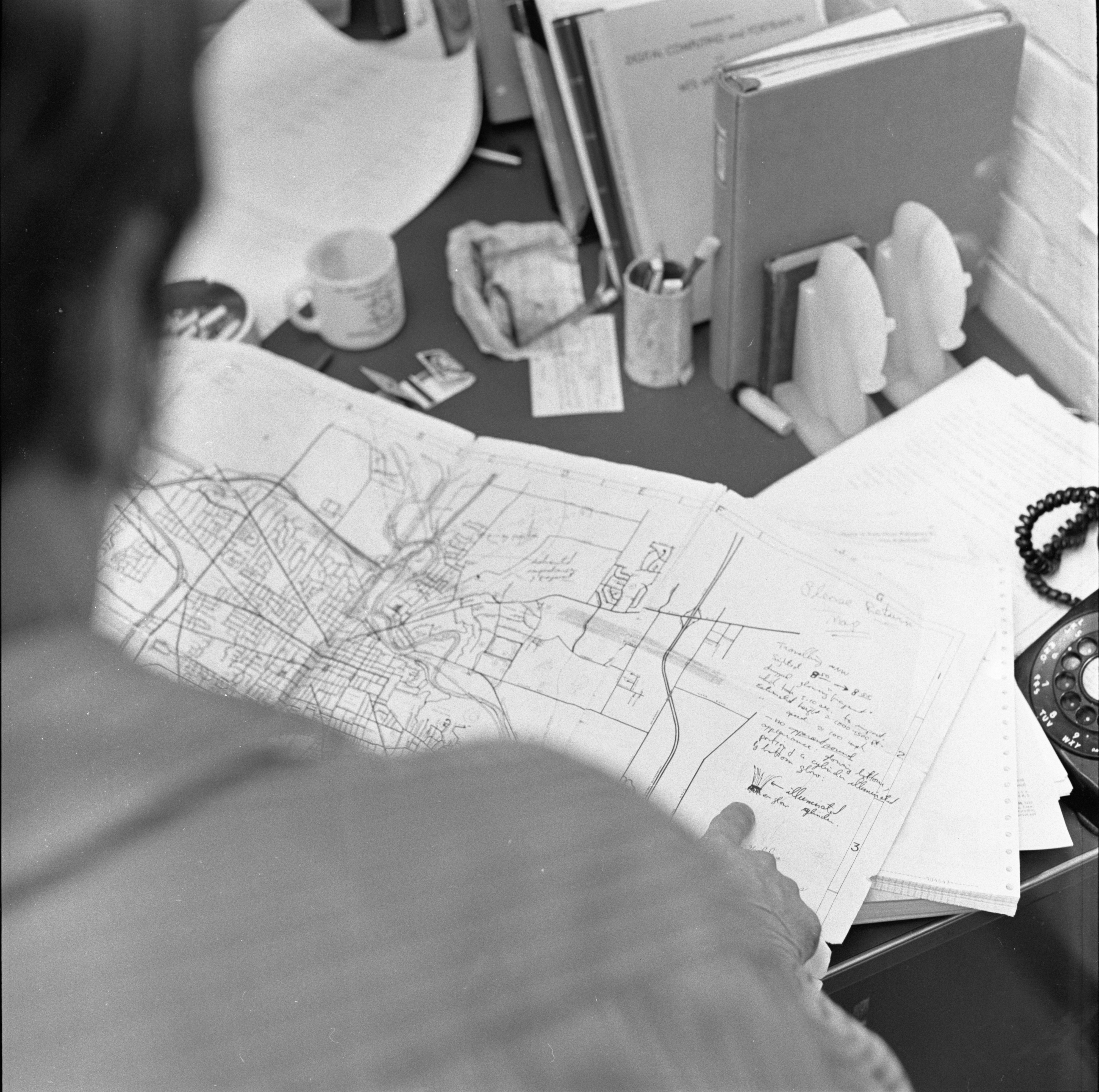
Dr. M. David Curtis Studies Map Of UFO Sighting, March 1973 Photographer: Cecil Lockard
Year:
1973
Copyright
Copyright Protected
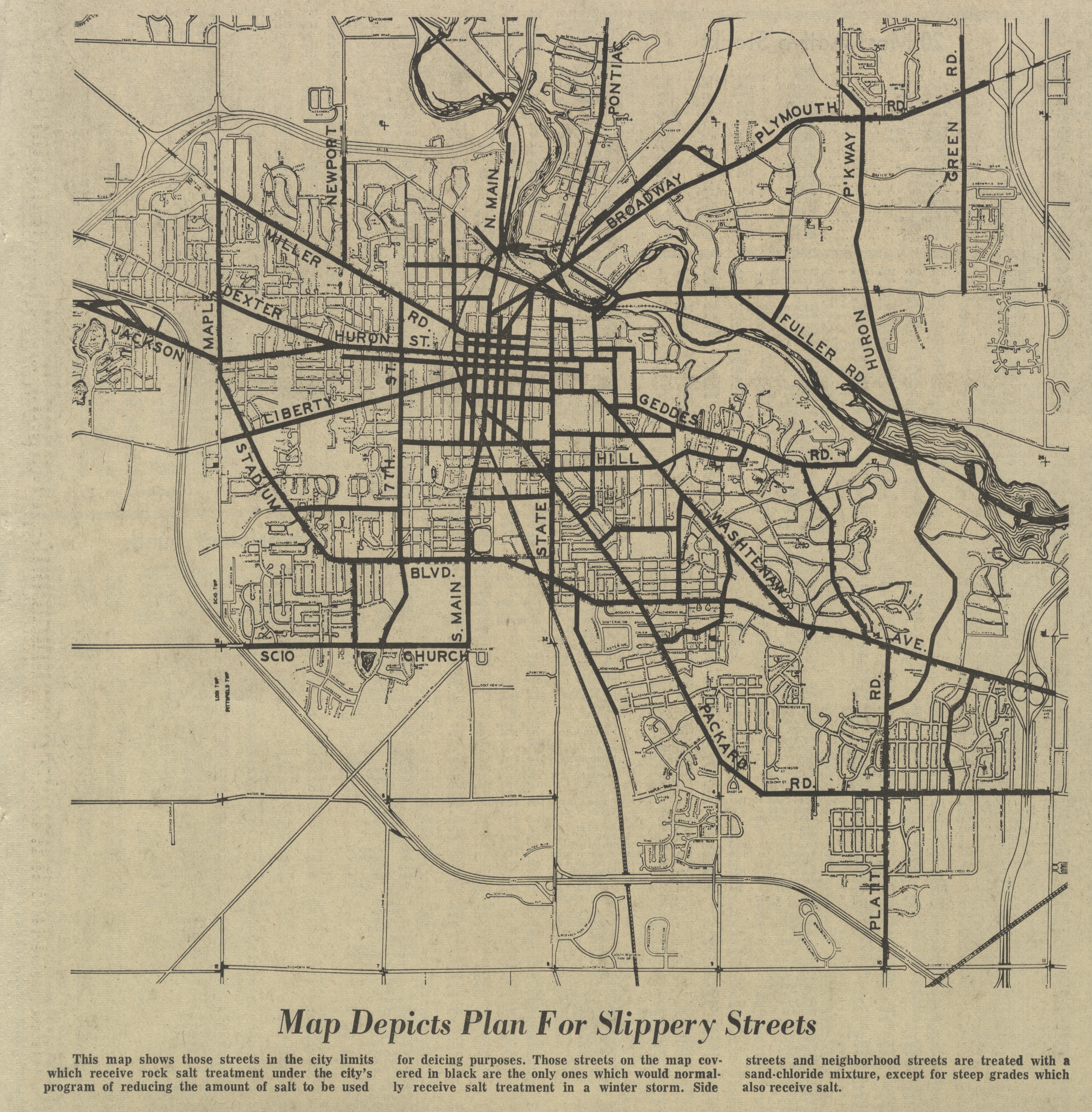
Map Depicts Plan For Slippery Streets
Parent Issue
Day
24
Month
January
Year
1971
Copyright
Copyright Protected
- Read more about Map Depicts Plan For Slippery Streets
- Log in or register to post comments